Conservation Cartography with Mongabay-India (Part VIII)

Our collaboration with Mongabay-India began in October 2021, with the objective of enhancing their stories with our spatial analysis expertise. This blogpost documents the articles we’ve worked on together in May and June 2023.

A hill town in Nilgiris district pays the price for poor waste management

Map of the Nilgiri Biosphere Reserve.

Kotagiri town in Nilgiris district is experiencing a rise in human-wildlife interactions due to fragmented forests, open dump sites, and landfills that attract wildlife. The Nilgiris district is landlocked in the Western Ghats region and consists of a fragmented forest area. However, it falls within the Nilgiris Biosphere Reserve, which aims to promote human-animal coexistence through its core, buffer, and transition zones.


[Explainer] What are floodplains and how have they been managed in India?

Satellite imagery of Mahad city and tehsil in Raigad district, Maharashtra, before and after heavy rains in July 2021. The tehsil and city have been built on the floodplain of the Savitri river.

India is highly susceptible to flooding, and the situation worsens due to construction in floodplains. Only a limited number of states have floodplain zoning policies, and experts emphasise the importance of implementing these laws in other flood-prone states. To visualise the impact of development in floodplains, we utilised open-source satellite imagery to study flooding in two regions of India.

Satellite imagery from 2022 of the Commonwealth Games Village built on the floodplains of Yamuna river. The venue flooded before the games in 2010.

We didn’t start the fire? Speculations over cause of Goa forest fires continue; state plans recovery

Goa experienced devastating forest fires in March 2023, resulting in the destruction of 418 hectares of land and causing significant harm to biodiversity and ecology. The cause of the fires remains uncertain, with speculation ranging from slash and burn techniques to high temperatures and scarce rainfall. Cashew farmers affected by the fires deny their involvement and seek compensation. 

Map representing burn scars obtained by analysing pre and post-fire conditions from February and March 2023, respectively.

Experts suggest preventive measures like fire lines and rainwater trenches. Over a 10 to 12-day period, 74 fire incidents were reported, affecting wildlife sanctuaries and surrounding villages. A total of 418 hectares, including forest land, were destroyed.

Despite Chamba order, stopping plantation on migratory routes of pastoralists in Himachal still a long journey

The Himachal Pradesh Forest department's Chamba circle issued an order in November 2022 acknowledging that tree plantations along migratory routes hinder pastoralists' access to quality fodder. Local pastoralists welcomed the order but called for its extension to other forest circles. The adherence to the current instructions from the grazing advisory committee to cease such plantations, have been lacking.

Migratory routes of pastoralists and the tree plantations on their path that pose as hurdles.

Afforestation activities in Himachal Pradesh have increased vulnerability for pastoralists, leading to invasive species expansion and disruption of seamless connectivity to green pastures. The Chamba circle's order aimed to address these concerns and aligns with prior research highlighting the hardships faced by pastoral communities due to hindrances in accessing green pastures during their seasonal migrations.

Migratory routes of pastoralists and the tree plantations on their path that pose as hurdles.

The information regarding pastoralists was obtained from an order by the Himachal Pradesh Forest Department. As per department records, 2,809 plantations took place in the state between January 2016 and July 2019. Data for 785 plantations were missing, as per a study. The maps represent 384 plantations in Chamba Circle with complete data.

Migratory routes of pastoralists and the tree plantations on their path that pose as hurdles.

The Dhapa land was originally part of the East Kolkata Wetlands, which serves as Kolkata’s natural sewage treatment system and was designated a Ramsar site in 2002, as a wetland of global importance.

The Dhapa landfill in Kolkata has been a source of frequent fires and declining air quality since 1987. To address this issue, the National Green Tribunal recommended biomining and bioremediation methods for waste clearance. However, progress has been slow, with only 0.78 million tonnes out of 4 million tonnes processed as of February 2023.

Landfills contribute to global warming due to methane emissions, and the target of clearing Dhapa by June 2024 is uncertain. The state government must clear the remaining 80% of waste within a year to meet the recommended deadline or face penalties. 

The landfill's fires have caused health problems, with PM10 concentration exceeding standards. Municipal solid waste landfills rank as the third-largest source of methane emissions, exacerbating fires and worsening air quality.


(Note: This is the eighth blog in the series, on our collaboration with Mongabay-India. Read the previous blog here, and the first in the series, here.) 

Identifying Forest Fire Scars with GEE

In March 2023, the serene forests of Goa experienced forest fires at an alarming scale. While there are many theories regarding the cause of the fires, mapping is helpful to know the scale of the fires and understand the extent of the damage. The sites identified at this stage are also helpful to monitor recovery and possible spread of invasive species in the aftermath of fires. This can aid in efforts to restore and maintain forest health.

In this blogpost, we look at the use of Google Earth Engine (GEE) to locate burn scars and hence identify areas affected by fires. I’ll be outlining the steps taken and sharing the relevant code for each stage of the analysis.

Importing Satellite Imagery

function maskS2clouds(image) {
  var qa = image.select('QA60');

  // Bits 10 and 11 are clouds and cirrus, respectively.
  var cloudBitMask = 1 << 10;
  var cirrusBitMask = 1 << 11;

  // Both flags should be set to zero, indicating clear conditions.
  var mask = qa.bitwiseAnd(cloudBitMask).eq(0)
      .and(qa.bitwiseAnd(cirrusBitMask).eq(0));

  return image.updateMask(mask).divide(10000);
}

var dataset = ee.ImageCollection('COPERNICUS/S2_SR_HARMONIZED')
                  .filterDate('2023-02-01', '2023-03-31')
                  // Pre-filter to get less cloudy granules.
                  .filterBounds(goa)
                  .filter(ee.Filter.lt('CLOUDY_PIXEL_PERCENTAGE',1))
                  .map(maskS2clouds);
print(dataset) 

To begin, I implemented the ‘maskS2clouds’ function to filter out cirrus and cloudy pixels. This function uses the QA60 bitmask band of Sentinel imagery to create a mask that identifies cloudless pixels suitable for further processing. This process is applied across the entire image collection dataset.

Creating a burn scar map, necessitates pre-fire and post-fire images, for an estimation of the scarred area. For this purpose, I selected appropriate images of post and pre-fire scenarios from the image collection. I wrote the below code to be able to display all the images date wise in the image collection to the map view.

Display All Images

//Add date attribute to all images to display the images and select the required //
dataset = dataset.map(function(image){
  var str = ee.String(image.get('system:index'))
  var sdate = str.slice(0,8)
  //var sdate = ee.Date(image.get('system:time_start'));
  image = ee.Image(image).set('date',sdate)
  return image;
})

print(dataset, 'with date')
var listOfImages = dataset.toList(dataset.size())
print(listOfImages)

//Add all the images in the dataset to the Map view //////
for(var i = 0; i < 28 ; i++){
  var image = ee.Image(listOfImages.get(i));
  var date = image.get('date')
  Map.addLayer(image, band_viz, ''+date.getInfo())
}

By attributing a date to each image and displaying them by date, I could visually assess the quality of the images in the collection. The first part of the code adds date as an attribute to all the images in the image collections. The second part displays the images using their date attribute. The output of the code is displayed below. This format of display helped me to gauge the quality of all the images in the collection. This further guided my selection of the suitable images for the pre and post-fires scenarios.

Example of all images displayed in the map view.

With all the images on display, I selected the 13th of February 2023 as the pre-fire image and the 10th of March 2023 as the post-fire image. This approach as in the above display also highlighted if the selected images need to be mosaicked. Mosaicking is joining two or more contiguous satellite images for analysis in order to cover the entire area of interest. Accordingly, I proceeded to convert the images to a list, then selected the required images and mosaicked them.

Selecting Pre-fire image

dataset = dataset.toList(dataset.size())
print(dataset, 'imageCollection')

//mosaic of 13/02/2023 - pre fire image.
var preFire = ee.ImageCollection([ee.Image(dataset.get(3)),ee.Image(dataset.get(6)),ee.Image(dataset.get(8)),ee.Image(dataset.get(11))])
preFire = (preFire.mosaic()).clip(goa)
print(preFire,'preFire')
Map.addLayer(preFire,band_viz,'preFire')

Selecting Post-fire image

//mosaic of 10/03/2023 - post fire image.
var postFire = ee.ImageCollection([ee.Image(dataset.get(26)),ee.Image(dataset.get(25)),ee.Image(dataset.get(24)),ee.Image(dataset.get(23))])
postFire = (postFire.mosaic()).clip(goa)
print(postFire,'postFire')
Map.addLayer(postFire,band_viz,'postFire')

The next step involved calculating Normalized Burn Ratio (NBR) for both pre and post-fire images. NBR relies on Near Infrared (NIR) and Short Wave Infrared (SWIR2) reflectance data. Burnt areas exhibit high reflectance in the SWIR2 region and very low reflectance in the NIR region of the electromagnetic spectrum. The NBR is designed to exploit this difference in reflectance along the spectrum. NBR is formulated as follows:

NBR = (NIR - SWIR2) / (NIR + SWIR2)

The NBR was calculated for both pre and post-fire images, using the below code.

Normalized Burn Ratio (NBR) Calculation

//Finding Pre and post fire NBR = normalized burn index ratio = NIR-SWR2/NIR+SWIR2
var PreNumer = preFire.select('B8').subtract(preFire.select('B12'))
var PreDenomin = preFire.select('B8').add(preFire.select('B12'))
var PreNBR = PreNumer.divide(PreDenomin)
//Map.addLayer(PreNBR,{},'Pre-NBR')

var PostNumer = postFire.select('B8').subtract(postFire.select('B12'))
var PostDenomin = postFire.select('B8').add(postFire.select('B12'))
var PostNBR = PostNumer.divide(PostDenomin)

The ensuing step involved determining the difference between pre and post-fire NBR images. The resultant output shows us the extent of burnt area in the region.

Difference between Pre and Post Fire NBR

//Subtracting postNBR fron PreNBR for scar map
var scar =PreNBR.subtract(PostNBR)
var palette = ['1a9850','91cf60','d9ef8b','ffffbf','fee08b','fc8d59', 'd73027']
Map.addLayer(scar, ,'ScarMap')

In subsequent stages, I incorporated the application of a threshold to isolate the scarred regions, which were then vectorized using a mask.

Define thresholds

// Define thresholds
var zones = scar.lt(0.09).add(scar.gt(0.09)).add(scar.gte(0.2))
zones = zones.updateMask(zones.neq(0));

I chose the thresholds by closely examining pixel values in the scar map using the Inspector Tool in GEE Code Editor interface. The ‘Inspector’ displays the pixel value at the point chosen on the map, for every displayed layer.

Inspector tool highlighted in the screengrab.

The output of the ‘define threshold’ step here was a raster with two values, 1 and 2. By this means, all values less than 0.2 were classified as 1 and while those greater than 0.2 were assigned the value 2. Using the code below, I converted the classified raster to a vector, yielding a downloadable KML file to create a comprehensive map of the affected area.

Reduce to Vector

// Convert the zones of the thresholded scars to vectors.
var vectors = zones.addBands(scar).reduceToVectors({
  geometry: goa,
  //crs: nl2012.projection(),
  scale: 10,
  geometryType: 'polygon',
  eightConnected: false,
  labelProperty: 'zone',
  reducer: ee.Reducer.mean(),
  bestEffort: true,
  maxPixels: 3784216672400
});


// Display the thresholds.
Map.setCenter(74.13215, 15.46816, 10);
Map.addLayer(zones, {min: 1, max: 3, palette: ['0000FF', '00FF00', 'FF0000']}, 'raster');

// Make a display image for the vectors, add it to the map.
var display = ee.Image(0).updateMask(0).paint(vectors, '000000', 3);
Map.addLayer(display, {palette: '000000'}, 'vectors');

In summary, employing this method was effective to identify forest fire scars in Goa. The inclusion of  ground points of scarred areas were valuable for ground truthing. Thresholding plays a very important role in delineating scarred areas, and hence ground truth points are helpful. If you’re involved in fire scar mapping, this demonstration could be a beneficial reference. Kindly get in touch via our contact form, if you have any further questions.

Link to the code: https://code.earthengine.google.com/c1010c05dd2762d18626b76a90112223

(Note: This code does not include the required shapefiles for the code to work, this is for reference only.) 

Mudflats to Mangroves

‘Tyācī sarva khāraphuṭīcī jamīna | It's all mangroves now.’ 


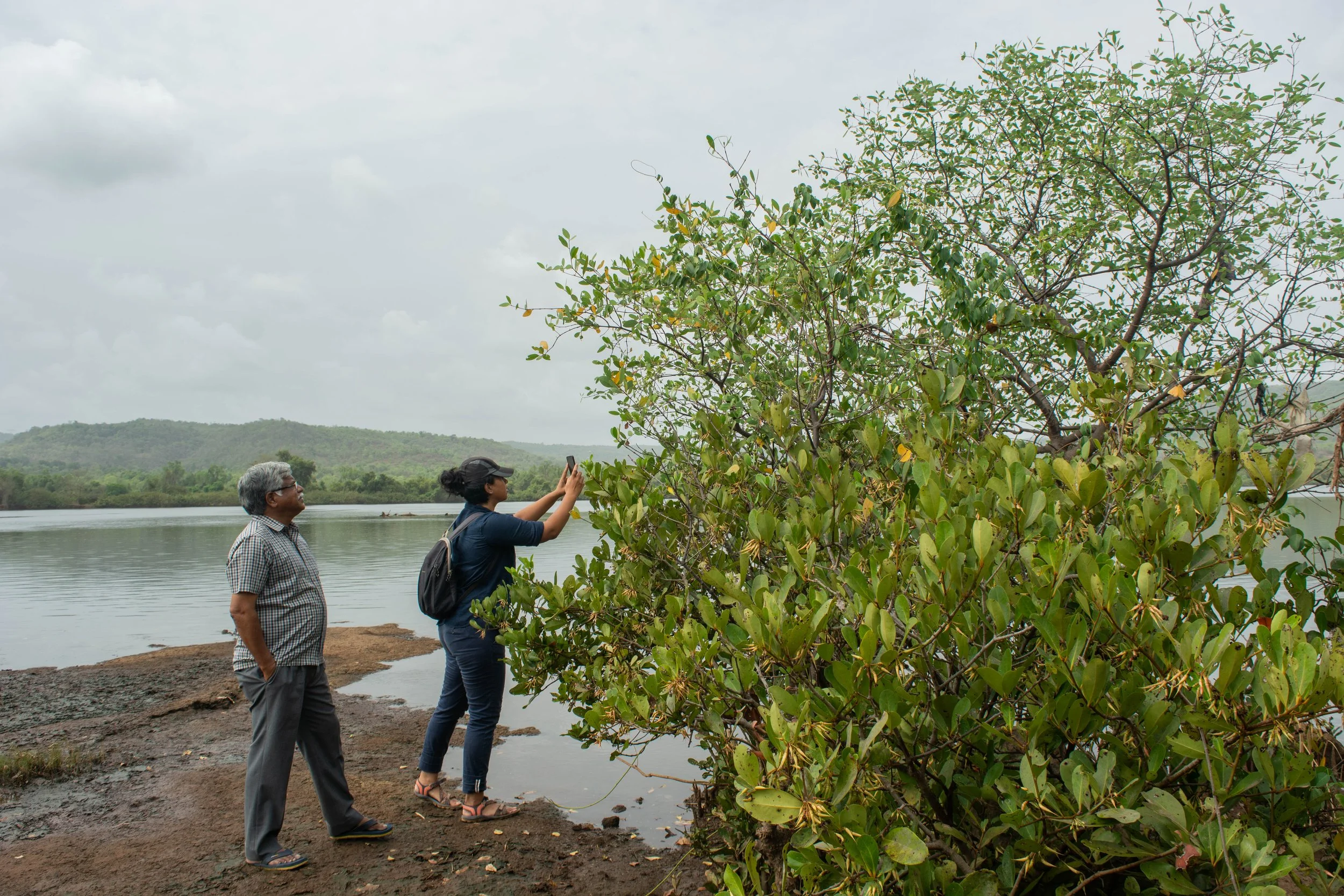
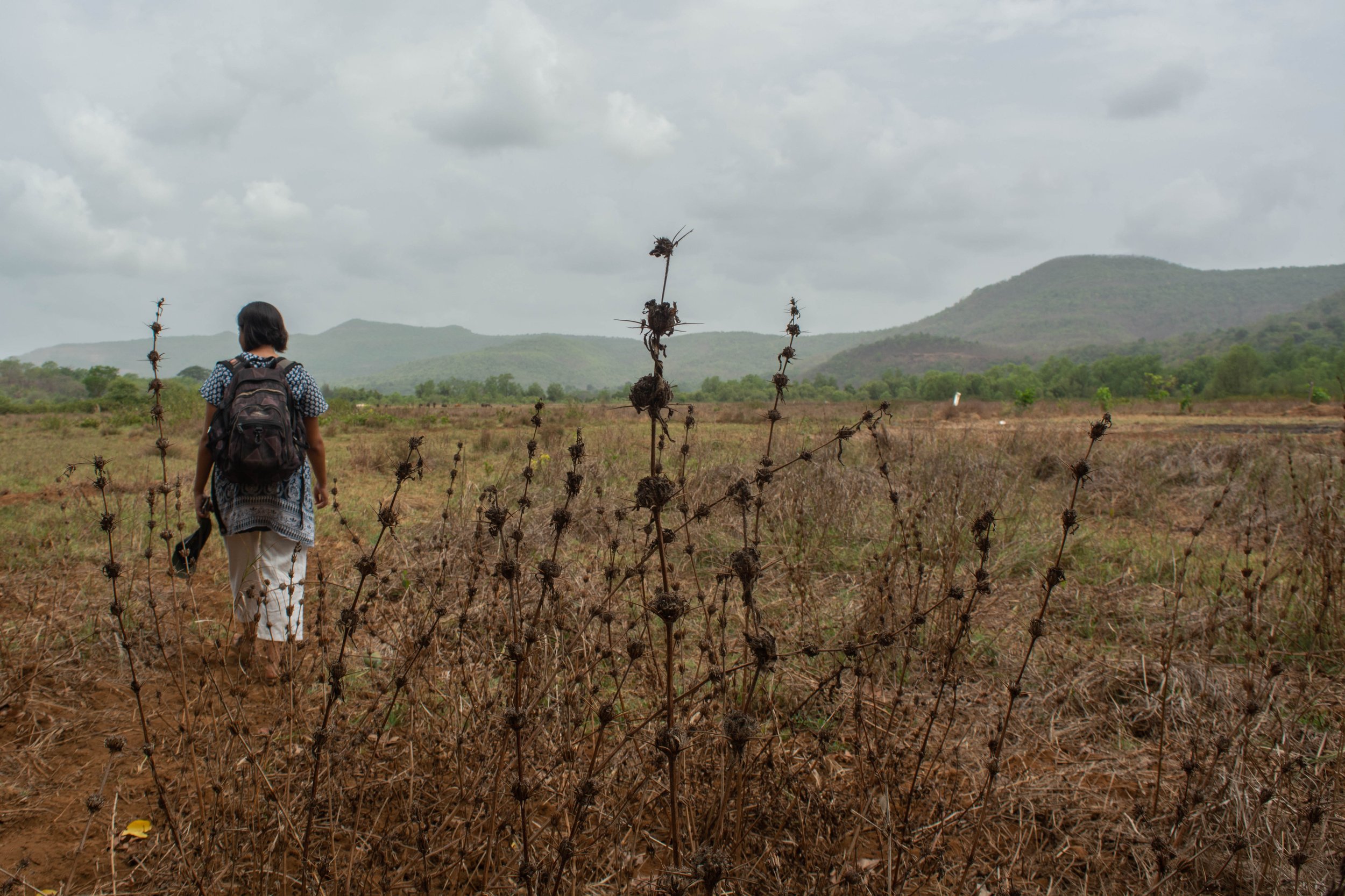
Growing where land and water meet, mud collected around the tangled mangrove roots, with shallow mudflats surrounding them. Patches of mangroves alongside the river were pointed out to us by our guide, an elder from the village, with the repeated observation – ‘it’s all mangroves now’ – as we walked on the river banks of the Savitri in Maharashtra.

We conducted this field trip in May 2022, with our collaborators Farmers for Forests (F4F) and EcoNiche to test a pilot model that encourages mangrove regeneration on fallow land unsuitable for agriculture.

Mangrove presence in Raigad, Maharashtra

Mangroves are found in tropical and subtropical latitudes, growing in slow-moving waters that allow sediments to accumulate. All species of the mangrove plant produce fruits, seeds, and seedlings that float in the oceans before taking root in fresh, brackish water. Muck builds up around the seedling’s roots, forming the surface for mudflats. In a few years, as the trees grow, the land area surrounding them also increases, growing an ecosystem around themselves. Because of their ability to act as carbon sinks, mangroves are often acknowledged as a compelling nature-based solution (NbS) to fight climate change. In November 2021, TfW and EcoNiche pitched a project that was selected for WRI’s Land Accelerator Grant which is aimed at business programmes to restore degraded forests and farmlands. Focusing on mangrove and seagrass conservation, the project, named the Reimagining Coasts Initiative, made it to the top 3% of nearly 500 applicants and won the innovation grant. Through this grant, we explored possible mangrove conservation and plantation in rural Maharashtra with our collaborators Farmers for Forests (F4F) who work in the area, and are familiar with local stakeholders. 

These villages on the river banks are within 30 to 50 km of the Arabian sea. Farming practices here evolved to include the raising of bunds to prevent saline backflow into the fields from the river. Community construction and maintenance of these bunds allowed agriculture to develop in the region. However, in present times, these bunds have collapsed from lack of maintenance due to the dwindling of the farming community. As per the elders of the community, a variety of factors, such as the search for a better quality of life, different career options and monetary benefit, to name a few, have led to the younger generation migrating to urban centres. At this point, the population of the village consists primarily of senior citizens. The resulting increase in salination has rendered parts of these lands unsuitable for agriculture and has seen the natural return of mangroves. This makes this an interesting site to investigate mangrove restoration and conservation.

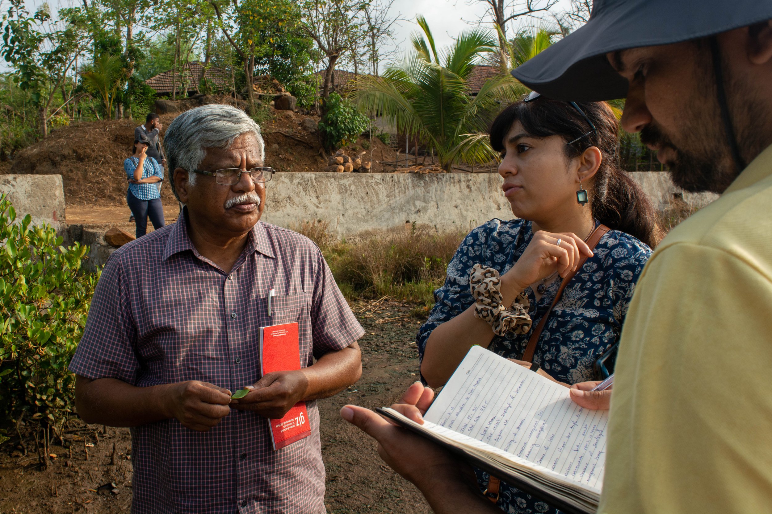
Team members interacting with an interested landowner to verify site location.

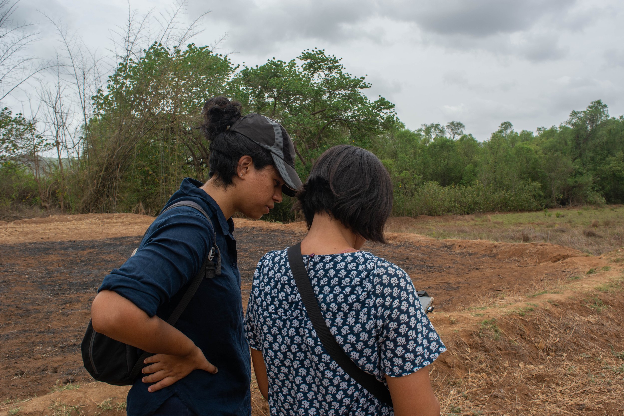
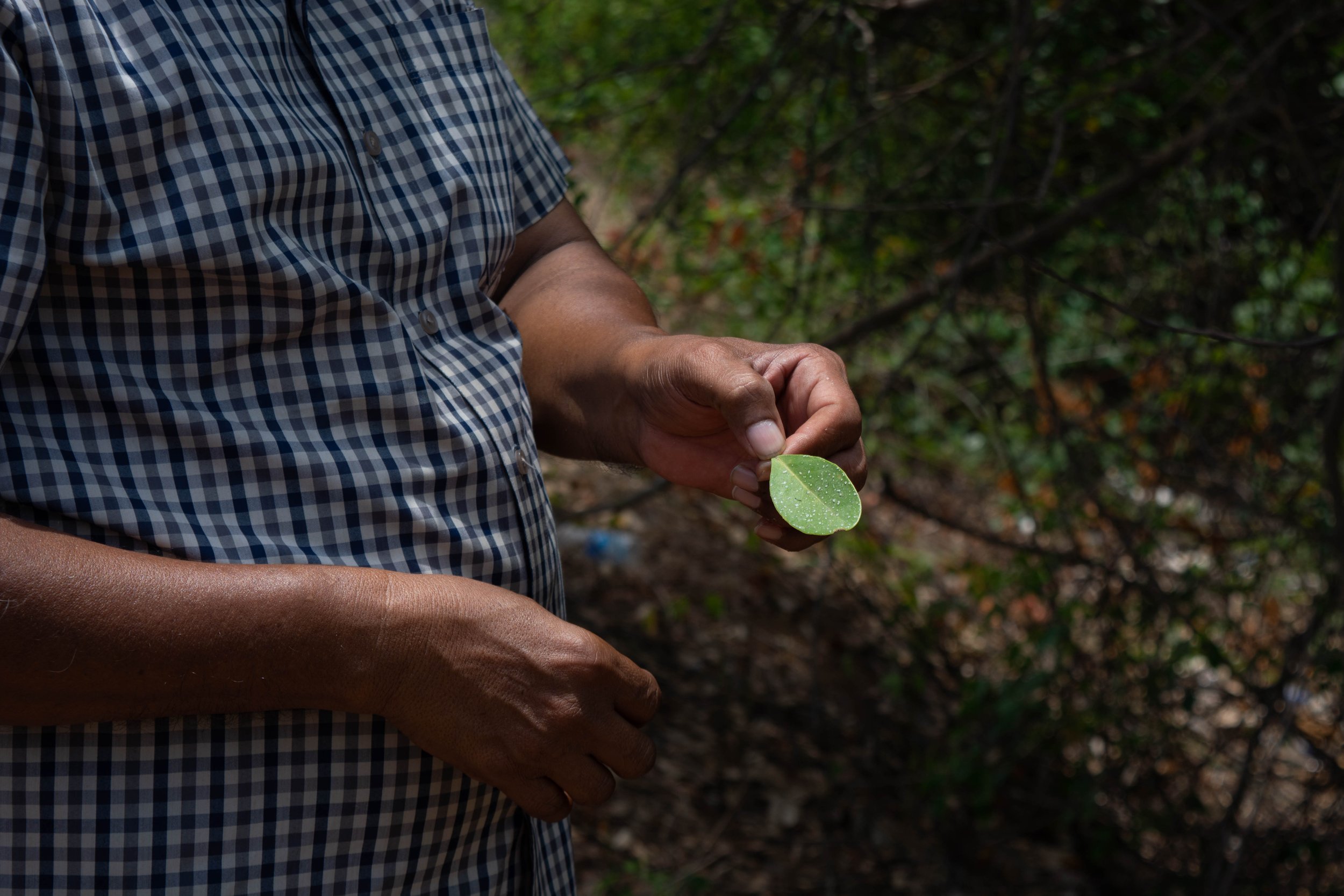
For their projects, the current model by F4F begins with the establishment of a dialogue with landowners in the region who may be interested in plantation or restoration on their land, in return for financial benefits. In this case, they were exploring restoration of mangroves, a new endeavour for them. Our field trip began with discussions with landowners and the village sarpanch, who had prior engagement with F4F. We were also joined by Dr. V. Selvam, an authority on mangroves in India. Accompanied by village elders, we walked through the village, to the edge of the river bank; to trace the path of salinity in their lands. This process helped us identify the main channels and breaks in bunds, while understanding the extent of salinity-induced features. Dr. Selvam guided us with information on the mangrove ecosystem flora while identifying the mangrove family and sub-varieties, while we took copious notes. We carried out photo-documentation of the species, while simultaneously listing their presence manually by noting scientific names, common names and local names. 

This exercise was repeated in every site we visited during this field visit. We also used our Uncrewed Aerial Vehicle (UAV) to aerially survey potential sites for mangrove restoration. The aerial imagery collected was used to discuss the land that landowners were interested in inducting into our project. This was a task that would have taken longer and been far more taxing if our surveys were restricted to the ground alone. Alternatively, using satellite or land survey based maps, the precision and understanding of the decision making may have been affected.

In the weeks following the field trip, we found that some policy blocks prevented us from seeing the project through to implementation. However, it has opened an avenue for us to explore and work towards for the future, and in other regions.


A combination of data gained from the ground, coupled with remote monitoring offers new opportunities to monitor nature-based solutions (NbS). However, standard operating procedures for carrying out such surveys, with information on the methods and tools, require further development. We are actively engaged in this journey to refine techniques for using this data– to inclusively plan and effectively monitor restoration efforts.

Presence of halophytic weed in a potential site for mangrove forestation.

Globally, there is a growing tendency towards ramping up the use of nature-based solutions. Enhancing ecosystems on the whole and addressing social concerns while generating environmental, economic, and societal value, NbS can help restore damaged ecosystems and carry out conservation efforts. These efforts ultimately have net positive impact, both locally and globally, benefitting the climate.