Our collaboration with Mongabay-India began in October 2021, with the objective of enhancing their stories with our spatial analysis expertise. This blogpost documents the articles we’ve worked on together from November 2022 to April 2023.
Hangul, the shy Kashmiri deer, is facing the threat of extinction as its habitat shrinks

Around six to seven cement factories have come up near Khrew, very close to the Dachigam National Park where the hangul is found.
The hangul population has drastically declined from an estimated 5,000 in the early 1900s to a mere 261 or possibly fewer individuals today. The decline is attributed to various factors, including habitat fragmentation caused by human activities such as urbanisation, illegal industries, mass tourism, and military presence. Cement factories, established in the mid-1980s due to abundant limestone deposits, are particularly concerning as they negatively impact the hangul's habitat and contribute to the population's decline.
We worked on a map visualising the locations of cement industries around Dachigam National Park, where the hangul is found.
India aims to go big on sugarcane-based ethanol, but water intensity of the crop throws up concerns

Map depicting sugarcane production in Maharashtra.
India aims to reduce its reliance on imported crude oil by achieving a 20 percent ethanol blending target by 2025, requiring 1000 crore litres of ethanol. Currently, ethanol is primarily produced from molasses, a sugarcane by-product, which consumes a significant amount of water. Studies suggest that converting sugarcane juice to ethanol is a more water-efficient process. In Maharashtra, sugarcane farmers are discontent with the offered price rate for the crop, payment delays, lack of transparency in weighing, and rising input costs.
Nagaland’s first bird count event spells hope for bird and wildlife documentation in the state

The citizen science records displayed do not indicate the comprehensive presence/absence of the species and its complete distribution. Design by Kartik Chandramouli/Mongabay.
The Tokhü Emong Bird Count (TEBC) in Nagaland, India, marked the state's first bird documentation event. Organised by Bird Count India, the Wokha Forest Division, and the Nagaland Forest Management Project, the four-day event involved 18 e-birders from four districts.
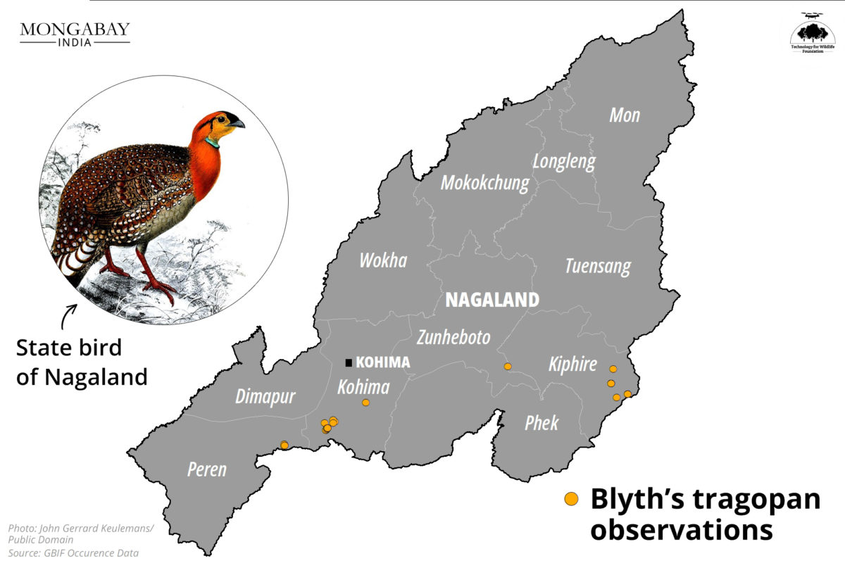
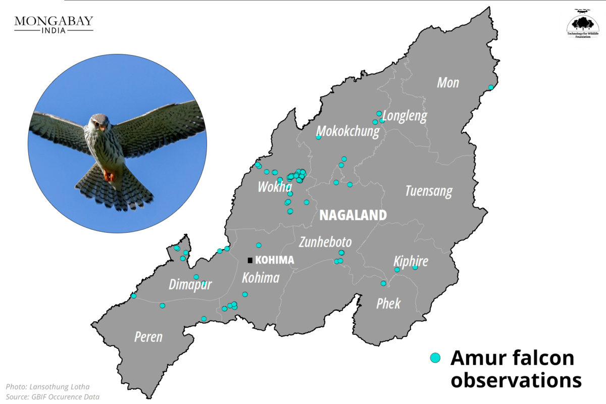
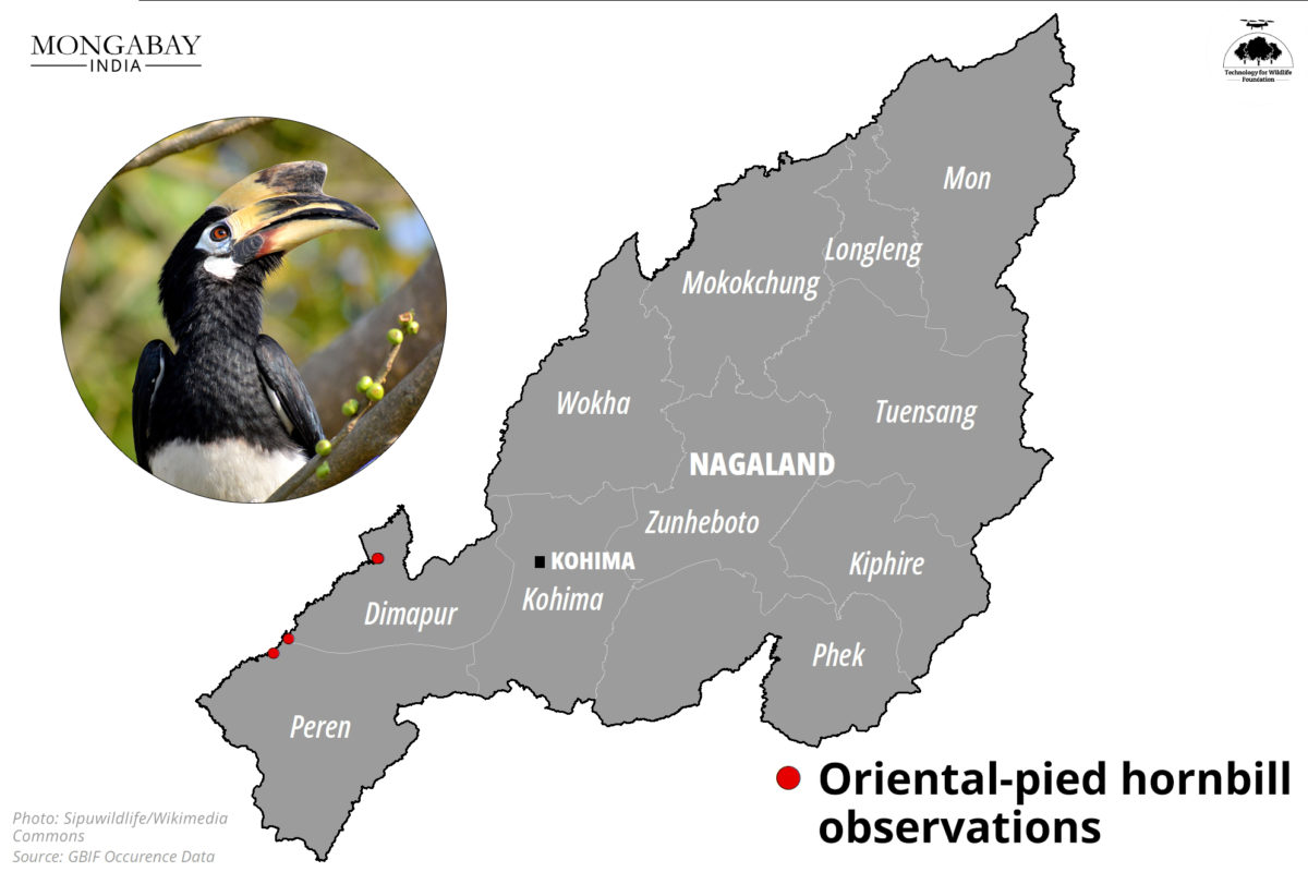
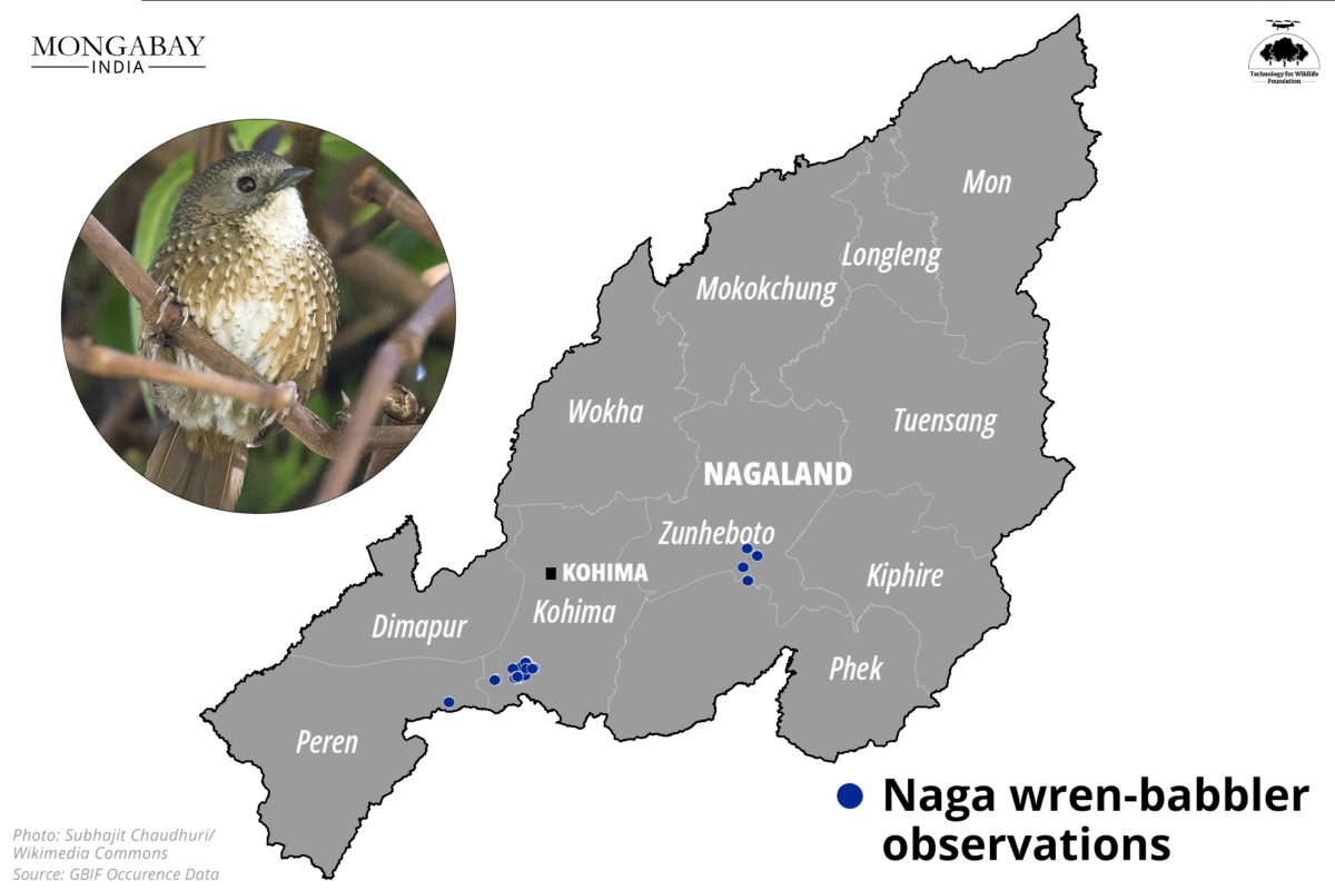
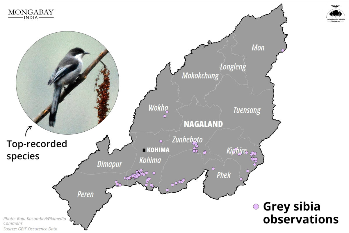
They identified 178 bird species, including notable sightings of the Amur falcon, blue-napped pitta, and brown shrike. The TEBC aimed to promote birding and conservation among young participants, with workshops on birding techniques and data uploading on eBird.
Hydropower projects proposed in the Dibang watershed in Arunachal Pradesh. The red markers indicate the Etalin HEP envisaged as a run of the river scheme on rivers Dri and Talo in the Dibang Valley district.
The Etalin project, located in a biodiversity-rich area, has sparked controversy due to its potential environmental impact. The Forest Advisory Committee (FAC) refused to grant the Stage-II or final forest clearance, considering the numerous concerns raised through representations. The decision was influenced by Arunachal Pradesh's recent inability to declare a national park in the same valley where another mega dam has been approved for construction. The map visualises the proposed hydropower projects in the Dibang watershed, with the Etalin project marked in red.
Urban and peri-urban farming can play a small role in reducing carbon footprint
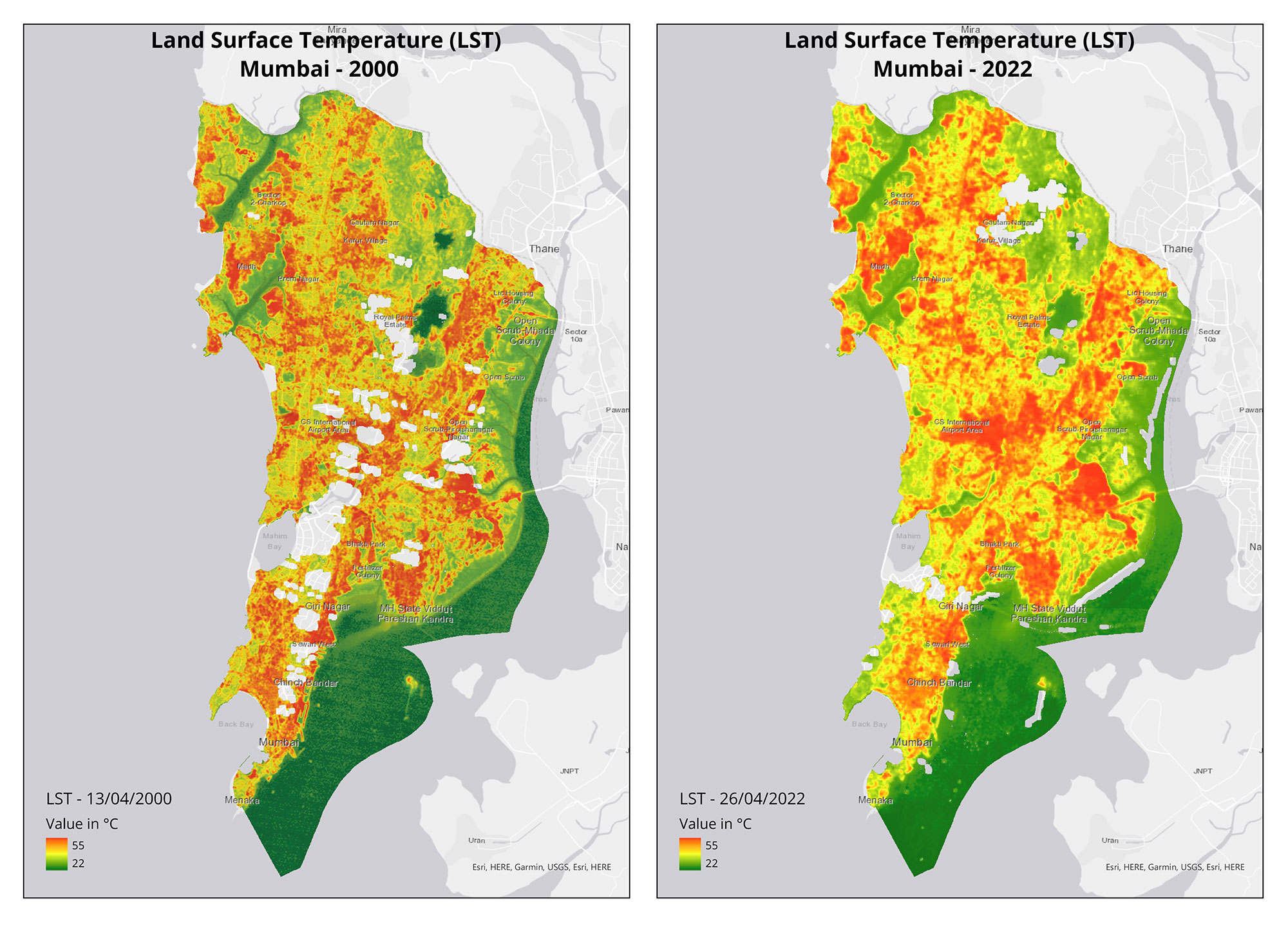
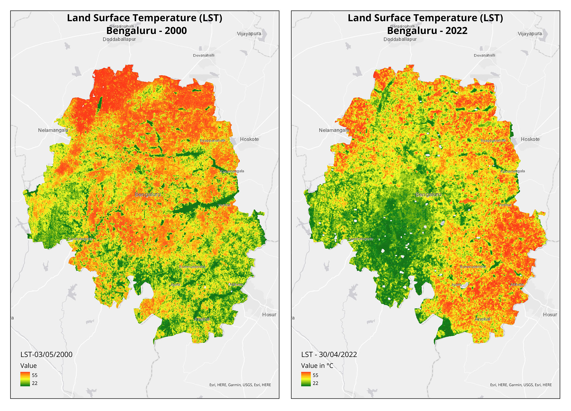
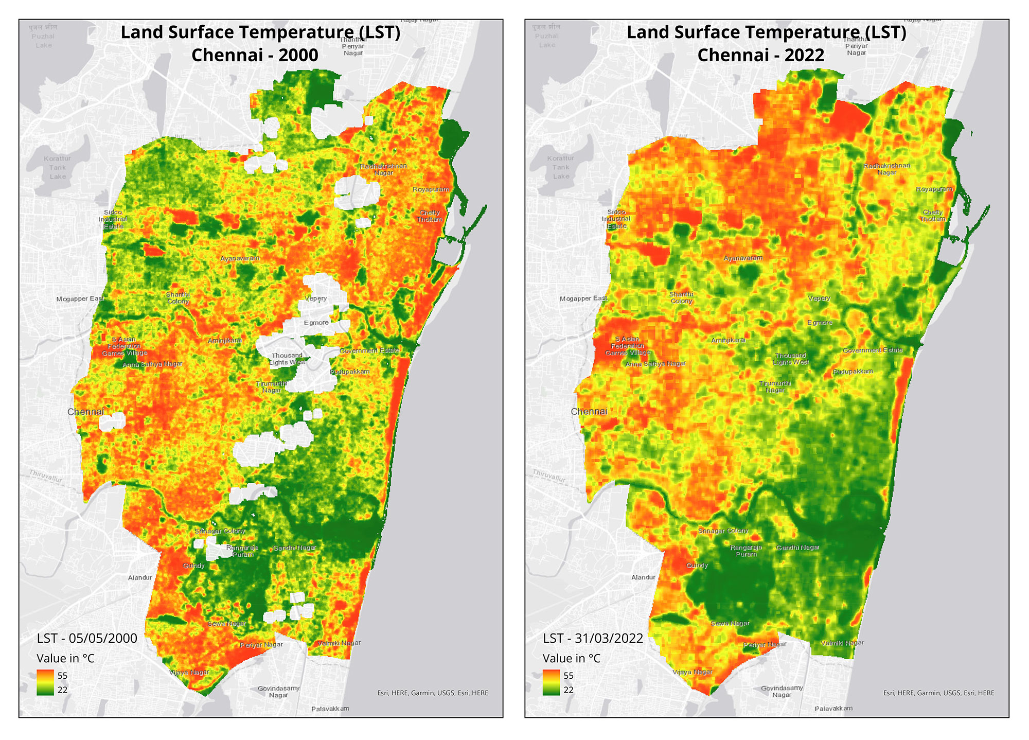
Urban and peri-urban agriculture (UPA) is gaining popularity in Indian cities as a means to promote climate action and sustainable development. While the climate mitigation impact of UPA may be limited, a study from IIT-Madras suggests that it can contribute to increasing carbon stocks and reducing land surface temperatures in urban areas.
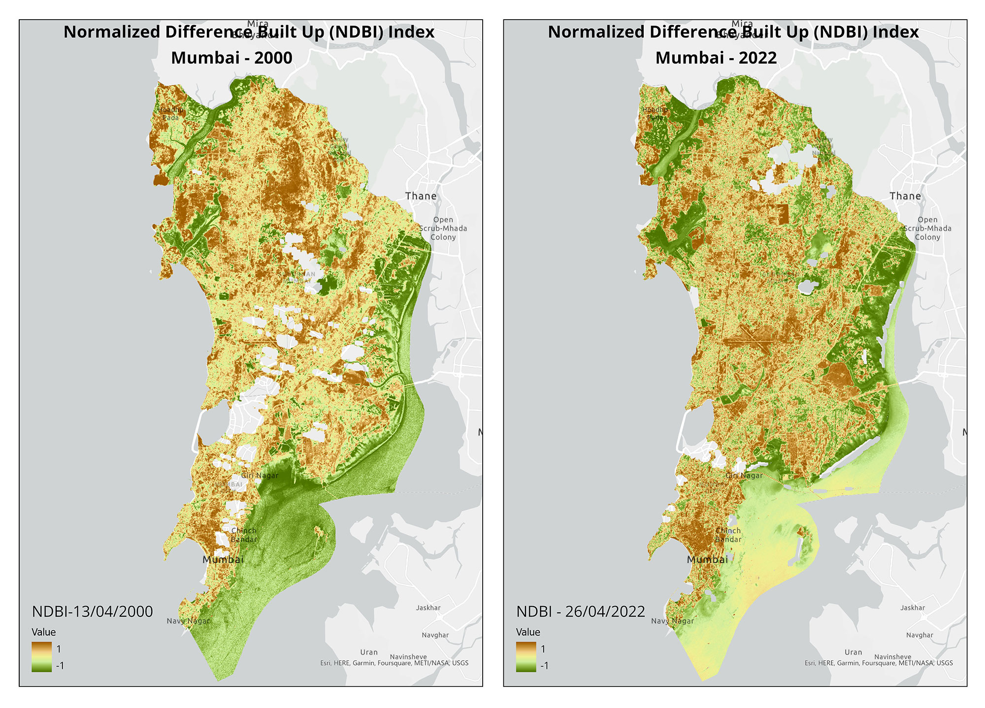
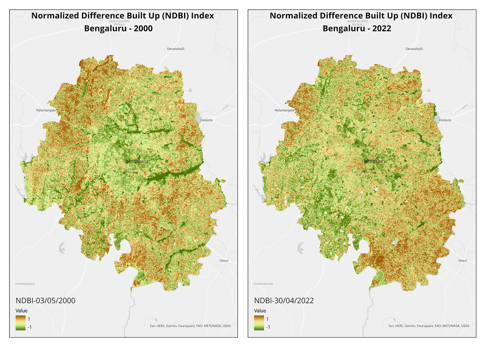
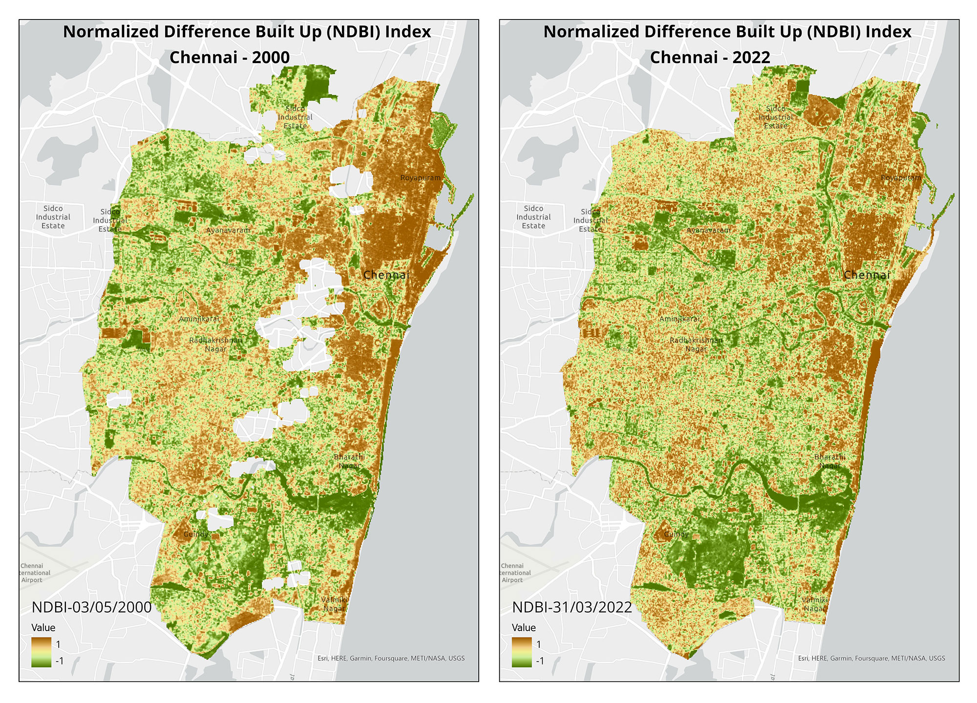
Beyond climate benefits, UPA has additional advantages for urban planning, including enhancing individual and community well-being, improving urban food security, and generating green job opportunities. Maps accompanying this article visualise the potential effect of UPA on build-up areas and land surface temperatures in Mumbai, Bengaluru, and Chennai.
(Note: This is the seventh blog in the series, on our collaboration with Mongabay-India. Read the previous blog here, and the first in the series, here.)