Mapping port development in Karnataka

There are plans to build a set of ports along the coast of Karnataka, with potential impacts on both coastal communities and wildlife in the region. Independent journalist Supriya Vohra wrote a three-part story on this topic for Mongabay-India, and we prepared a set of maps to accompany these articles.

A visual representation of the 12 planned ports was unavailable; official government documents only contained details regarding the coordinates of the ports, and of the defined port limits.

An example showing the port limit descriptions for port Karwar in the Government document.

Eastern, northern, and southern limits of minor ports limits as defined by the Government, along the coast of Karnataka. Port limits for Tadri and Pavinakurve were unavailable.

For the first story, our task was to map one major and twelve minor ports of Karnataka. Descriptions from the Indian Hydrographic Charts for each port in the official notifications were used to map the port boundaries. The descriptions of the port limits were such that following the details, one could locate the cardinal directions. While the instructions for the northern, southern, and western boundaries were mostly straightforward, the eastern borders were somewhat complex as they went inland. So, obtaining a complete understanding of the descriptions was the necessary first step in creating the maps.

The next step consisted of downloading bathymetry data. Bathymetric data are depth contours of the sea floor. For most of the ports, coordinates were available for north and south directions in the description to estimate limits that fell in or around the shores. Lines from these points extended towards the west into the sea to the 30 metre contour line that forms the northern and southern boundary. The western limit is the line joining the northern and southern limits along the 30 metre contour line in the sea. As required, I mapped only the northern, southern, and western limits for all the ports, using the coastline of India as the eastern border. I downloaded the bathymetry data from GEBCO (General Bathymetric Charts of the Oceans) in GeoTIFF format. The other options for downloading the dataset are in 2D netCDF and ESRI ASCII raster format. The reason I chose the GeoTIFF format is simply because it is a more commonly used format. After importing the data to ArcGIS Pro, I created contours to locate the port limits. 

Locating Port Honnavar’s northern and southern points in Google Earth Pro.

For each port, I followed the description in the notification. I used Google Earth to locate the coordinate points. I used Google to search for a few landmarks in the descriptions first, as they were unavailable via either Google Earth or labelled base maps in ArcGIS Pro. After confirming the locations, I then marked the northern and southern points as described in Google Earth Pro and exported them to ArcGIS Pro in a .KML file format. It was only done for the northern and southern points, mostly because only these directions had landmarks or coordinates in their description. The western border would be the 30 metre contour line connecting north-south. Once I created the contours and located the coordinates for each port, I finally started digitising the port limits by connecting those points in ArcGIS Pro. The coordinates of the few ports marked on the map were sourced from the official Karnataka Port website and exported after locating it on Google Earth.

Map on the road connecting the ongoing Honnavar port project.

The second story focused on the proposed port at Honnavar, where a road of around four kilometres long is being constructed. The entire stretch is the fish-drying ground of the coastal communities, and part of the proposed road also cuts through forest land. The port area includes confirmed nesting sites for the vulnerable Olive Ridley turtle, and there are also a few nests close to the road. 
We were provided with the turtle nesting sites data, originally collected by the Honnavar Forest Department, while the boundaries of the proposed Honnavar port and road were available in .kml format from PARIVESH. Making this map was relatively straightforward, as most of the data were already available, and it just had to be combined and represented.

Turtle nesting sites (2015-2022) as per Honnavar Forest Department records.

The third story lists the discrepancy between the turtle nesting sites as reported by the Honnavar Forest Department, and that presented to the public by the National Centre for Sustainable Coastal Management (NCSCM). In brief, the NCSCM actually indicates that the turtle nesting sites are in the Arabian Sea; Olive Ridley turtles, like all sea turtles, nest on land. Our analysis indicates that the NCSCM made a very basic conversion error when converting latitude-longitude pair values from one format to another, which was not identified before publication of their report.

Creating these maps was exciting as well as challenging; the most difficult part was to create port boundaries from only the written descriptions of directions, locations and depths. By visualising the issues surrounding these developments, we hope for the best possible ethical outcome for these ecologically sensitive areas, and the human and wildlife communities resident in them. 

By the river Gandak

In March, 2022 I was thrilled to find out that we were headed for a field trip to Bihar. I was excited for many reasons, including that this was going to be my first field trip with Technology for Wildlife Foundation - the experience of travelling to Bihar, encountering gharials and dolphins, the beauty of the Gandak (tributary of Ganga) and my first drone flight. The trip aimed to study the behaviour of gharials and Ganges river dolphins in the Gandak river during pre-monsoon season when the water levels of the river are shallow.

On the 15th of April, 2022, my colleagues and I left for our field trip to Bihar. We landed in Patna early that day and were later joined by our collaborators from Wildlife Conservation Trust (WCT). Together, we started for Bagaha - our field site, an amazing seven hour drive from Patna. It was the peak of summer and we needed to constantly hydrate ourselves. I was slightly tired of the heat and was trying hard to keep awake. Nevertheless, the Gangetic floodplains kept me in awe for the most part.

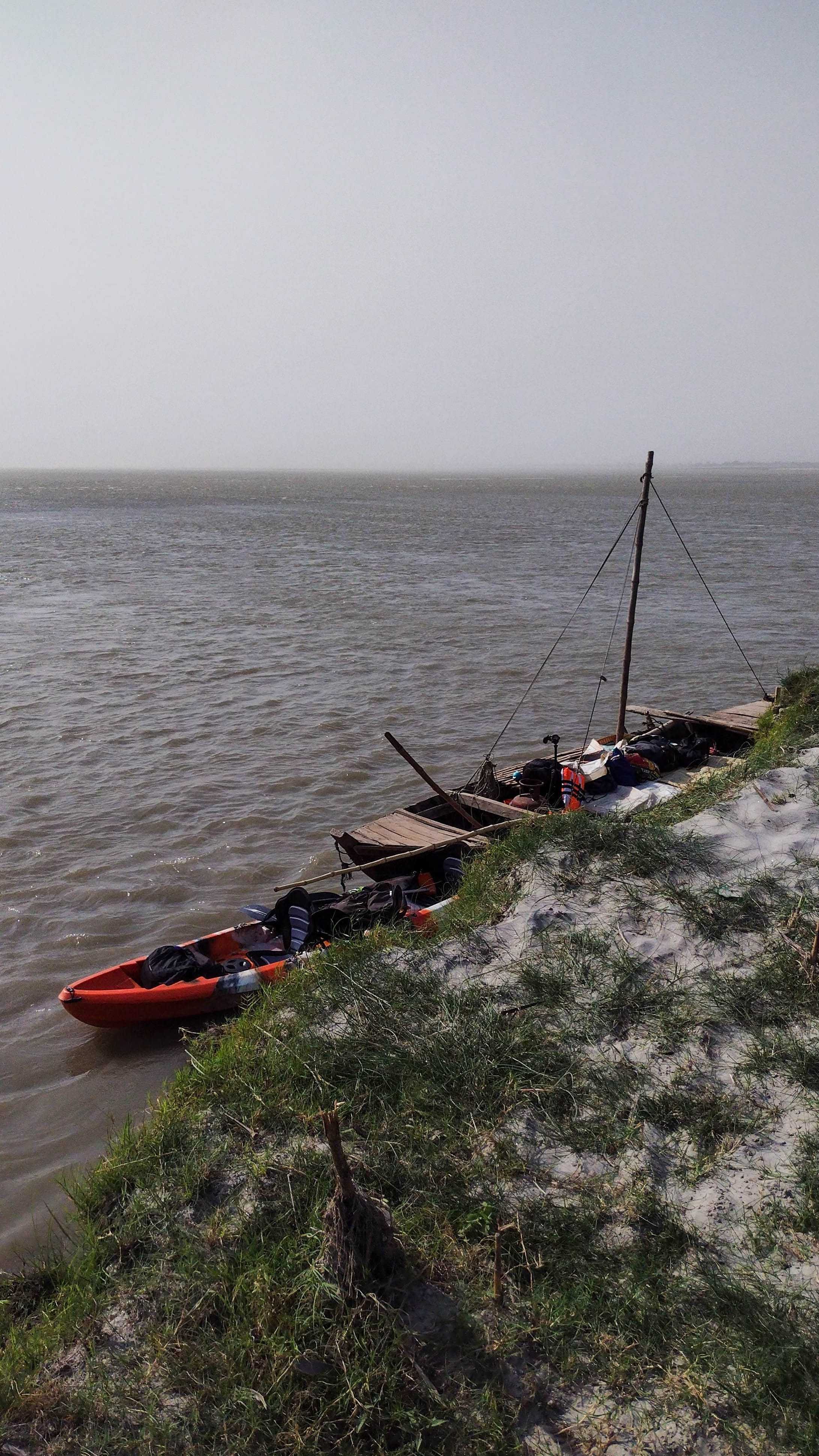
The next morning we left to survey the river after having chai and chole puri for breakfast. After setting up the boat with a CPOD (Cetacean and Porpoise Detection) to collect data on dolphin frequencies and other activity in the area, all of us hopped onto the boat to begin our survey. Our objective was to identify a good stretch of the river which could be the field site, a site with a good number of gharial and Gangetic river dolphin sightings. This boat ride was especially beautiful and memorable. We were in the middle of the vast stretches of the Gandak and its floodplains. The quietude of the Gandak was addictive. At one point, there was a large enough sandbar for us to hop-off the boat, where we tried flying a kite as the wind was on our side. The idea was to mount a camera and a GPS device to track the route to record features in such terrains. This was so much fun; we would probably try mounting the camera on our next field trip. The halt lasted for a good half an hour, after which we resumed the survey. By the evening, we were able to finalise the field site. We also spotted many birds, some turtles and gharials (thanks to binoculars), and a few dolphins! The day came to an end with a beautiful sunset by the river Gandak.

Our ride in the river Gandak. Image: Nancy Alice/ TfW

Our ride in the river Gandak. Image: Nancy Alice/ TfW.

The following day we arrived at the field site and prepped to fly the drones over gharials basking under the sun. We didn’t mean to disturb them but they were quite sensitive and would promptly glide back into the water when they heard our activities. We worked out how to operate our drones  and observed them happily without creating any disturbance. Drone-flying seems like an elegant art, from setting its orientation, launching it to getting it back to us. After a few flights by colleagues to observe gharials, I was prompted to fly it back home, with a brief primer on the controls. This was my first attempt with the drone and I was still learning how to navigate it. The toughest part though, was not being able to see the screen under such sunny conditions, and to keep a track of the battery. One of my colleagues, Shashank kept referring to video games as the best practice to have a better understanding of drone controls. Hence, video games and drone flying are up next on the bucket list for me. 

Most gharial captures were smooth as they would be basking on the sandbars, so they were clearly visible. The dolphin captures were comparatively more spontaneous and calculated. Among others, we had identified a mother and baby dolphin in our field site. Its sightings would be frequent at certain times during the day. If the weather was not windy at those times, we flew the drones over them to observe and were able to capture them swimming happily. These captures were delightful. It would often start with one of us spotting some frantic splashes in the water followed by a confirmation from the binocular personnel and then the drones launched. Spontaneous and almost ticklish! We analysed the drone videos the following day and worked on making drone transects for better video capture of gharials and dolphins. Over the days that followed, we flew the drones in pre-programmed transects and analysed the imagery for sightings. I remember having a good long conversation with Shashank, where he was explaining the legal rules of drone flying. It cleared a lot of doubts on  safe and sustainable drone flying. 

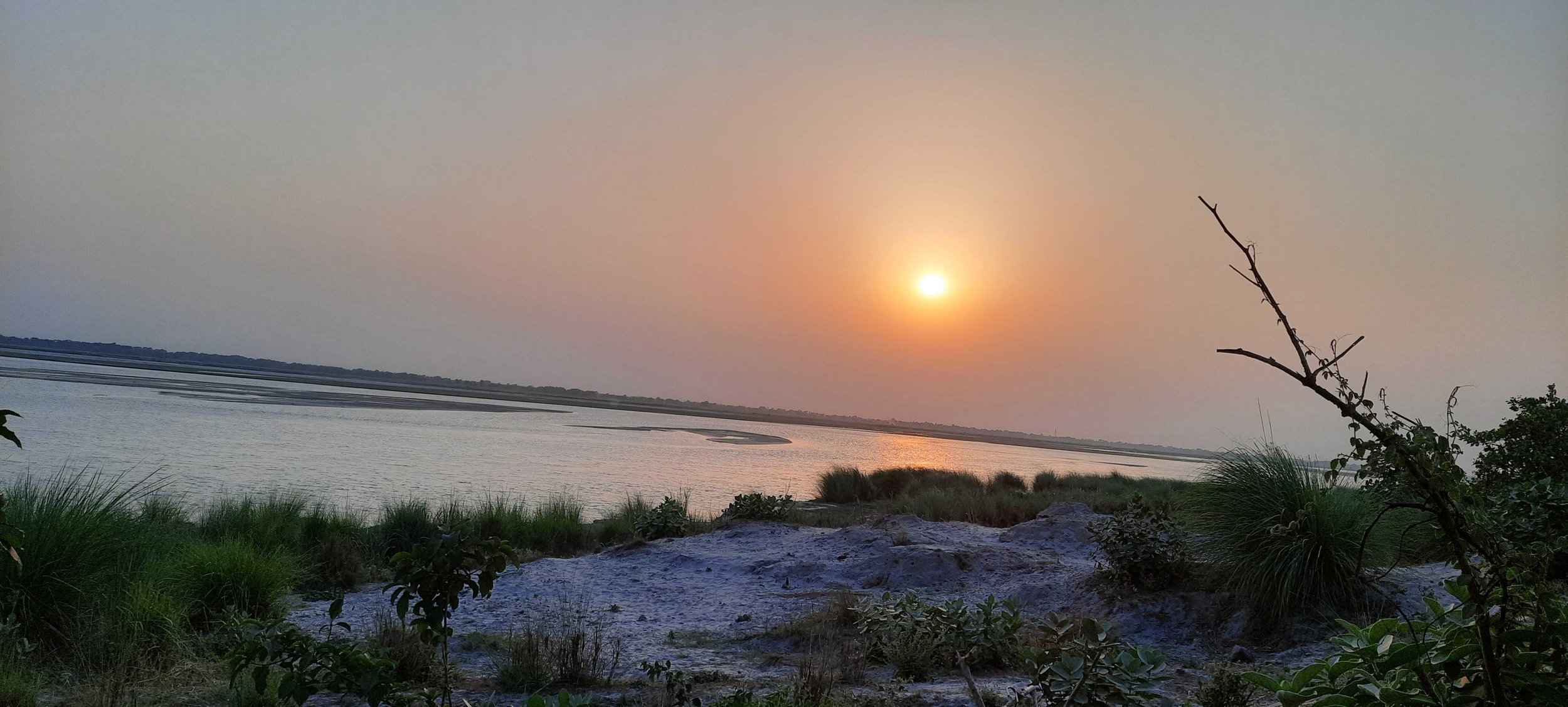
In conclusion, the field site was beautiful! Oranges, cucumbers and bananas kept us happy amidst the summer days. We would often catch the sunset by the river. Even on the last day at the field site, we sat by the banks and gazed at the beauty of the river. The river was super gracious to let us peep into some of the life it housed and for the unforgettable sunsets.

Sunset at the field site.

The next day we drove to the Valmiki Tiger Reserve at the India-Nepal border. The temperatures dropped slightly enroute to the reserve. After ten days of gazing at floodplains, we were then resting our eyes upon the Shivalik ranges at the horizon. We took a safari at the tiger reserve and it was calming to go around the trees. We spotted a number of avian beauties in the reserve - Emerald doves, Orange-headed thrush and the Paradise Flycatcher. Towards the end of the safari, we experienced mild showers, followed by hail stones. We rushed inside a temple complex to take shelter. Although brief, this little encounter with the temple was memorable. 

Author at the banks of the river Gandak. Nancy Alice/ TfW

The trip was a great learning experience for me and I am grateful for this opportunity. One of the greatest takeaways would be the discussions with my colleagues and collaborators about their journey through conservation and their love for the wild. While I reminisce over the memories of Gandak, I look forward to my next trip and hopefully as a trained drone pilot!

On moving to Goa

‘You have never been to the sea?!’ Yes, 27th July 2022, was when I headed out for Goa, and the sea, for the very first time. As usual, I had to leave my home in Bongaigaon, Assam, a day or two before my scheduled departure. Because travelling 185 km to Guwahati Airport on the day of departure, has always felt risky to me. At 8:45 AM, I boarded the flight from Guwahati, and by 2:40 AM, I was in Goa! After booking the pre-paid taxi and walking out of Dabolim airport, was when I said to myself, ‘Okay, the journey begins.’

Something about Goa that I observed and loved was the greenery as seen on my route from the airport. Before my arrival to Goa, I was assigned a task on mangroves to work on, and on the way to the city, I saw mangroves for the first time ever - it was amazing!

I was staying with one of my colleagues; after reaching, she welcomed me with a hot bowl of Koka noodles in her warm house. Strange, though this was the first time I met two of my colleagues, the warmth felt familiar. Later that day, I started house-hunting in Panjim with another colleague.

On the following day, we had a team meeting with the Mongabay-India team. While the discussions were on, we were offered some snacks; that’s when I tried bhakarwadi for the first time. It was delicious!

After a team dinner, we headed towards the Vagator beach around 11 pm. I had this kind of giggly excitement for I had never been to the sea. As it was pretty late, most shops were closed. We crossed through lanes with shops that sell crystals; ‘How fascinating!’ I wondered.

About 30 metres from the ocean, we could hear the sound of the waves crashing onto the shore. The sea was still not visible, but there was a cold breeze. A few more steps and I glanced at the sea; it gave me chills. With loads of mixed feelings rushing in, I walked head down, and only when I reached the shoreline did I gaze at the small white waves rushing in, only to return to the dark infinity. Rest of the team waited for my reaction to seeing the sea for the first time. And I never imagined my first encounter with the sea to be scary. 

I never imagined getting to do the things I was doing at the moment. Another day we drove to a local quarry to train with Varaha (our cute ROV).  Watching the turquoise blue waters that day, I regretted not knowing how to swim.

A few days later, we made our way to Caranzalem beach, not the usual way but through a narrow trail that felt like it was a scene from a movie. This time the sea was magnificent with the orange and pink hues of the setting sun. However, I had this dizzy feeling of being pulled away into the ocean by the waves. For a person who would lose balance in the pool, now witnessing such a large body of water was quite a big step towards conquering the fear of water itself.

Trail leading to Caranzalem beach.

On the weekend we drove to a point on top of the hill, where one could see the whole extent of the Caranzalem and Miramar beaches. It was early on a cloudy morning, and few fishermen were out with their boats. Some dogs accompanied others on foot, with crows, black kites, and stunning Brahminy kites flying high, just about where we were sitting. I witnessed the Brahminy Kite for the first time; in bright white and rustic orange, shining from the sun rays from the parting of the clouds that fell on it; it was majestic. It was soon after that that two tiny birds with tints of yellow and blue came crashing, fighting with each other, halted, noticed there was a human next to them and so quickly flew away. The next thing I did was I took out my phone to Google it and found out they were Olive-backed sunbirds. I was absorbed in the rush of excitement when something moved in a  palm tree nearby; it was a Greater coucal! Next, my colleague pointed toward two grey, big-headed flying birds. For a while, we watched the movement of what were most probably the same birds in a nearby tree. However, the canopy was too dense to see through. With a few glances and some Google searches later, we guessed that they were Grey hornbills. It was a beautiful morning, well-spent bird-watching and learning about them.  

The whole extent of Caranzalem and Miramar beaches.

Talking about birds, we recently went to Dona Paula beach, where we saw a big bird far away, near where the fishermen were fishing. I was sure that it was not a kite. It flew away from the beach, and I was sure what I saw was an angelic figure that had white on its body. But I didn’t know which type of falcon it was. It looked so magical. I was curious and hopeful that it would fly back, but disappointed, it didn’t, and it stayed on my mind for days. 

Recently, we went to a forested area where the river Mandovi met the Arabian sea. As we were staring up at the canopy covers of the oak trees, a big falcon came flying gracefully to the top of the canopy, displaying its white, greys, and blacks. It was the same angelic figure that I saw the other day. It was a white-bellied sea eagle, and yet again, it was playing the game of hide and seek. To get a clearer view, we walked closer to the river's embankments, but it had decided to forever play its game of hide and seek. Standing near the embankment, we saw Brahminy kites making their rounds- near the water and the fishing boats. The crows kept cawing, trying to chase the Brahminy kites away, missing their shots. And the  kites kept doing their business calmly, not minding the caws. And just when we were watching this play, there came the White-bellied sea eagle! Gracefully taking a round and vanishing into the canopy. While I was partially satisfied to see it again, its game of hide and seek only made me more eager to search for it. Apart from that, we also saw a wiggling Common Sandpiper. The white streaks on its wing bars when it takes flight are a sight to behold. And lastly, just when we turned back from the end of our trail, something flew in front of us and sat on a wire. So tiny! It was a pair of White-rumped Munias. They were very cute! We observed them for some time, and while they did not seem to be leaving anytime soon, we decided to leave. 

The White-bellied sea eagle in the middle.

Goa, for me till now, has been amazing. From meeting my colleagues for the first time to meeting the sea for the first time. From meeting a lot of new birds to having a crush on the White-bellied sea eagle. Moving to Goa has been wonderful!