Let’s open up the skies for drones

(Cross-posted from the Hindu Business Line, October 19th 2015)

Unmanned aerial vehicles are flying robots that provide some of the benefits of manned flight without its attendant risks and inconveniences. Commonly known as drones, they proved their worth on the battlefield during the 1973 Yom Kippur and 1982 Lebanon wars, after which numerous military forces began implementation of their surveillance and weaponised drone programmes. Today, India is reported to have some 200 Israeli-made drones in service, and is in the process of developing indigenous ones for military use. Civilians, however, are banned from flying drones.

Drones are not just used for military purposes; they have also been used by civilians around the world for a diverse set of non-conflict use cases. These include assisting aid agencies during humanitarian crises, helping farmers with their fields, providing a new perspective to journalists, letting conservationists rapidly monitor wildlife and conduct anti-poaching patrols, as well as simple recreational activity; flying a drone can be a lot of fun.

Drones, thus, have commercial value; they provide a much cheaper alternative to manned flight, and enable applications that were impossible earlier. Unfortunately, most new technologies come with their own dangers, and drones are no exception. They can occasionally crash. This matters most when the drone being flown is large and heavy, as a crash can damage property and harm people. Drones also occupy airspace that is used by manned aircraft, and an in-air collision or even a near-miss, could be disastrous. These are dangers that could occur unintentionally. However, there is also the fear that drones could be used to intentionally cause harm.

For these reasons, the relevant regulatory bodies of some countries have limited the public use of drones until these concerns can be addressed. In India, the Directorate General for Civil Aviation (DGCA) completely banned their use by civilians as of October 7, 2014. However, the authorities in other countries haven’t gone as far; in the US, the Federal Aviation Agency (FAA) allows the civilian use of drones with caveats, while their commercial use is licensed. While the various countries of the European Union (EU) currently have multiple regulations covering drone flights, the European Aviation Safety Agency intends to create common drone regulations, with the intention of permitting commercial operations across the EU starting in 2016.

The regulatory authorities of these countries have understood that drones are here to stay, and that their use can be extremely beneficial to the economy. A report by the Association for Unmanned Vehicle Systems International (AUVSI), a non-profit trade organisation that works on “advancing the unmanned systems community and promoting unmanned systems”, states that by 2025, the commercial drone industry will have created over 100,000 jobs in the US alone, with an economic impact of $82 billion. Drones can also contribute to the export market. For example, in Japan, where commercial drones have been licensed since the 1980s, Yamaha Corp has been producing drones for aerial spraying for agricultural purposes which are now exported to the US, South Korea, and Australia, generating $41 million in revenue for Yamaha in 2013-14. That’s small change compared to the current global market leader’s expected sales for 2015. SZ DJI Technology Co Ltd of Shenzen, China, was only founded in 2006, but by 2015, they controlled 70 per cent of the global commercial drone market and a higher percentage of the consumer drone market, for an estimated revenue of $1 billion.

These countries and companies have addressed the inherent dangers of drone technology by looking at technology- and policy-based solutions. The FAA and the UK’s Civil Aviation Agency (CAA) prohibit the flying of drones within five km of an airport or other notified locations, and drone manufacturers like DJI and Yamaha could enforce these rules by incorporating them into the drone’s control software. This means that a drone will be inoperable within these restricted zones. Outside these zones, drone misuse can be treated as a criminal offence. In the US, two individuals were recently arrested for two separate drone-related incidents: in one, the operator’s drone crashed into a row of seats at a stadium during a tennis match and in the other, the operator flew his drone near a police helicopter.

In India, the DGCA’s October 2014 public notification states that due to safety and security issues, and because the International Civil Aviation Organisation (ICAO) hasn’t issued its standards and recommended practices (SARPs) for drones yet, civilian drone use is banned until further notice. One year later, there are still no regulations available from the DGCA; the ICAO expects to issue its initial SARPs by 2018, with the overall process taking up to 2025 or beyond. Meanwhile, the loss to India’s economy, and the threat to its national security, will be enormous. Today, it is still possible to import, buy, build or fly small drones in India, despite the DGCA’s ban. This means that drone-users in India currently exist in an illicit and unregulated economy, which is far more of a threat to the nation than regulated drone use could ever become.

Finally, flying drones safely in India will require research and development to understand how they can be best used in India’s unique landscape. Such R&D occurs best in a market-oriented environment, which will not happen unless civilian drone use is permitted. Building profitable companies around drone use can be complicated when the core business model is illegal.

Like civil aviation regulators in other countries, the DGCA should take a pro-active role in permitting civilian use of drones, whether for commercial use or otherwise. Creating a one-window licensing scheme at the DGCA, where drone users only have to apply for permission from the ministries of defence and home affairs in special circumstances, would be a useful first step. Setting up a drone go/no-go spatial database would allow the DGCA to discriminate between these use cases and could also be mandatorily encoded into drone systems by their manufacturers. The DGCA should also discriminate between drones based on their size and weight; the smaller and lighter the drone, the less risk it poses. This should be recognised while regulating drones.

Whether it is to assist fishermen with finding shoals off the Indian coastline or conducting rapid anti-poaching patrols in protected areas across the country, mapping refugee settlements in Assam and Bengal for better aid provision or assessing the quality of national highways, drones can transform the way we conduct operations in India. Thus, a blanket ban on civilian drones in India is more of a hindrance to development than a solution to a problem. Drones are here to stay and the sooner India’s civilians are allowed to use them, the faster we can put them to work.

[ This article was commissioned by the Centre for the Advanced Study of India at the University of Pennsylvania and is also available on their blog. ]

From the Space Shuttle to a block of wood

Creating a 3D model of the Nanda Devi Sanctuary using SRTM data and a CNC router

NandaDevi_Zoom.jpg

I’ve had Nanda Devi and the Sanctuary surrounding her in my thoughts for a very long time, and she seemed like a fitting first attempt to bring spatial data out of the digital world and into reality. For the uninitiated, Nanda Devi is a mountain in the Indian Himalaya, and she’s always referred to as she: the goddess in the clouds. Surrounded by a protective ring of mountains, she towers over them all, and this space between the ring and the central peak is known as the Nanda Devi Sanctuary. Due to this ring, the first entry into the Sanctuary was only made in 1934, by Shipton, Tilman and their three porters, who entered via the gorge of the Rishi Ganga. The mountain herself was first summited in 1936 (see- Nanda Devi: Exploration and Ascent, by Shipton and Tilman).

The geography of the region is fascinating ( and the history as well; there’s a nuclear-powered CIA device somewhere inside the Sanctuary!) and the heights and depths of the various relief features make it a joy to visualise. In this post, I’m going to describe, in brief, the steps I used to get from the data to the final model in wood. While I’m sure most of this can be done using open-source tools, as a result of my current University of Cambridge student status and my @cammakespace membership, I have access to (extremely expensive) ESRI and Vectric software, which I’ve used liberally.

Relief map of the Nanda Devi Sanctuary and the Rishi Ganga gorge. The lighter the colour, the higher the elevation.

Relief map of the Nanda Devi Sanctuary and the Rishi Ganga gorge. The lighter the colour, the higher the elevation.

I have a repository of digital elevation data collected by the Space Shuttle Endeavour in 2000 (STS-99; Shuttle Radar Topography Mission). It’s freely available from CGAIR-CSI (http://srtm.csi.cgiar.org/) and is not difficult to use. In QGIS, it was cut and trimmed down to my area of interest around Nanda Devi; I was looking for a rough crop that would include the peak, the ring and the Rishi Ganga gorge. This relief map was exported as a GeoTIFF, and opened up in ArcScene, which is ESRI’s 3D cartography/analysis workhorse. ArcScene allowed me to convert the raster image into a multipoint file; as the tool description states, it “converts raster cell centers into multipoint features whose Z values reflect the raster cell value.” For some reason, this required a lot of tweaking to accurately represent the Z-values, but I finally got the point cloud to look the way I wanted it to in ArcScene.


The point cloud (red dots), overlaid on the relief map in ESRI ArcScene

The point cloud (red dots), overlaid on the relief map in ESRI ArcScene

I then exported the 3D model of the point cloud in the .wrl format (wrl for ‘world’) which is the only 3D format ArcScene knows, and used MeshLab, which is an open source Swiss-knife type tool for 3D formats, to convert the .wrl file into a stereolithographic (.stl) file which the next tool in the workflow, Vectric Cut3D, was very happy with. As a side note, Makerware was also satisfied with the .stl file, so it is 3D-print ready.

The final model in Vectric Cut3D, ready to be sent to the CNC router for carving.

The final model in Vectric Cut3D, ready to be sent to the CNC router for carving.

More tweaking in Cut3D to get the appearance right, and the toolpaths in order, and I was ready to actually begin machining. After an abortive first attempt where the router pulled up my workpiece and ate it, I spent some more time on the clamping for my second attempt. First, I used the router to cut out a pocket in a piece of scrap plywood to act as my job clamp; this pocket matched the dimensions of my workpiece exactly. After a bit of drilling, I had my workpiece securely attached to the job clamp, which was screwed into the spoilboard on the router.

The CNC router doing its thing

The CNC router doing its thing

For the actual routing itself, I used two tools; a 4mm ballnose mill and a 2mm endmill for the roughing and finishing respectively. It took about 45 minutes for the CNC router to create this piece. I love the machine, and am very grateful to the Cambridge Makespace for the access I have to it. In the near future, I’m going to try and use different CNC router tools and types of woods to make the final product look neater; specifically, a 1mm ballnose tool for the finishing toolpath would be very nice! I’m also going to try and make relief models of a few other interesting physical features.

The final product: A model of the Nanda Devi sanctuary in wood, based on data from the Space Shuttle and carved using a CNC router.

The final product: A model of the Nanda Devi sanctuary in wood, based on data from the Space Shuttle and carved using a CNC router.


S696, Maps and Atlases: The Cambridge Map Room

I’ve re-entered the academic world as a student at the University of Cambridge in the United Kingdom, and one of the benefits I’m enjoying the most is near-unlimited access to one of the world’s largest repositories of recorded information; the Cambridge University Library. Commonly known as the UL, this is a copyright library which means that under British rules on legal deposit, the library has the right to request a copy of any work published in the UK free of charge. Currently, the UL has over 8 million items, which includes books, periodicals, magazines and of course, maps.


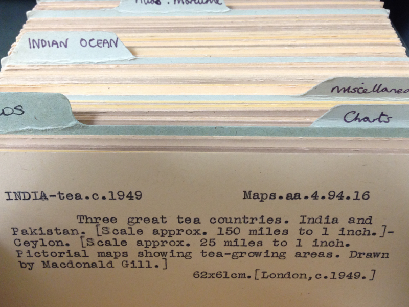
The Map Room in the UL is a fascinating place; it functions as the reading room for the Map Department, which holds over a million maps (as the librarian told me; Wikipedia claims it has 1.5 million). It’s not a very large room, as reading rooms go, but is a beautiful space and is very well managed. Everything is catalogued very efficiently with a filing card system, and there’s one card with the name, date of publication and classmark (UID/coordinates) for each map.  Visitors are not allowed to simply browse through the map collections; to refer to a map, one must fill out a request form with the appropriate details and submit this form to the library assistants, who will then pull out the required map folio from its storage location. The title of this post comes from the fact that  map holdings with classmarks beginning with ‘S696′, ‘Maps’ or ‘Atlases’ are held in the Map Room, in various drawers and cabinets.

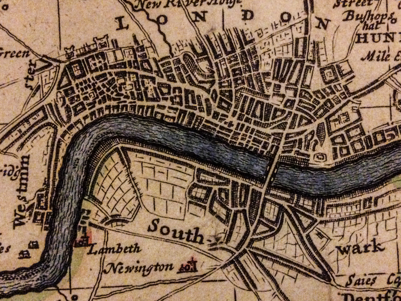
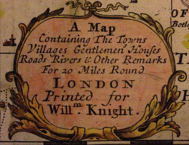
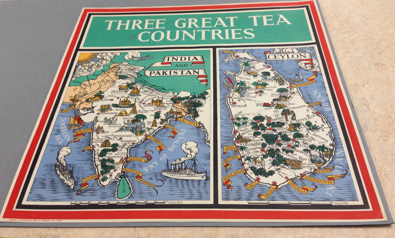
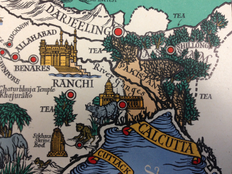
The Map Room is a pen-free zone; if you’re writing something, use a pencil. Smartphones and hand-held cameras are allowed, but under UL policy photos cannot be taken of the building itself. With prior permission however, it is possible to take images of material in the UL, which I did. The first series is from a map on display in the UL; titled “A map containing the towns villages gentlemen’s houses roads river and other remarks for 20 miles around London“, it was printed for a William Knight in 1710 and is a wonderful piece of cartography. The second series is from a map I requested using the card-index system; this map dates back to 1949 and beautifully illustrates tea-growing regions in the Indian-subcontinent.

If there’s a map in the UL you want an image of (for non-commercial or private-study purposes only!), I’d be happy to do what I can to help; I would actually be very grateful for an excuse to spend an afternoon looking at maps.