Selected Projects
machine perspectives of alien landscapes

In August 2019, we set out to visit a set of high-altitude lakes in the Indian trans-Himalaya. Supported by grants from the National Geographic Society, our expedition’s dual goals were to use robots to explore these lakes, looking for signs of plastic contamination. Our field work covered nine lakes across Ladakh and Spiti which we photographed and mapped using aerial robots. We used our SofarOcean Trident to capture the first-known footage from within these lakes, documenting the activities of both small crustaceans as well as the presence of plastic waste. We also collected plastic litter from around these lakes, first documenting it by manufacturer and type and then ensuring that it was properly disposed of. Our media and data from this expedition are being used, by us and by other conservation organisations, to aid in advocacy and policy planning efforts to ensure that these lake ecosystems are not irreparably degraded.
A 360° aerial image acquired from above the wetlands of the Tso Kar basin.
ghost gear detection assessment
Abandoned, lost or otherwise discarded fishing gear (ALDFG), collectively and commonly known as ‘Ghost Gear’, is a major threat to marine life. The World Wildlife Fund for Nature, India commissioned us to examine existing technological solutions for ghost gear identification, and to recommend appropriate methods for their detection in Indian waters. We reviewed the available literature on the subject and conducted interviews with experts, following which we used a deliberative process to synthesise information and provide recommendations. Our final report was shared with our client to assist with their planning processes, and with selected conservation practitioners who we felt could make best use of it.

drone ethics

While civilian drones in India are widely used, there are no explicit guidelines regarding their ethical use, and extensive anecdotal evidence as to their misuse. Thanks to a competitive grant from WeRobotics, we assessed the current practices and ethical implications of using non-military drones in India. We conducted a literature review, interviewed practitioners and industry experts and conducted a field visit to understand the impacts of drone use on rural Indian communities. We presented our work in Nairobi, Kenya in February 2020 at the Unusual Solutions pitch event, and will be releasing our work as both an academic paper as well as an accessible report targeted at drone users.
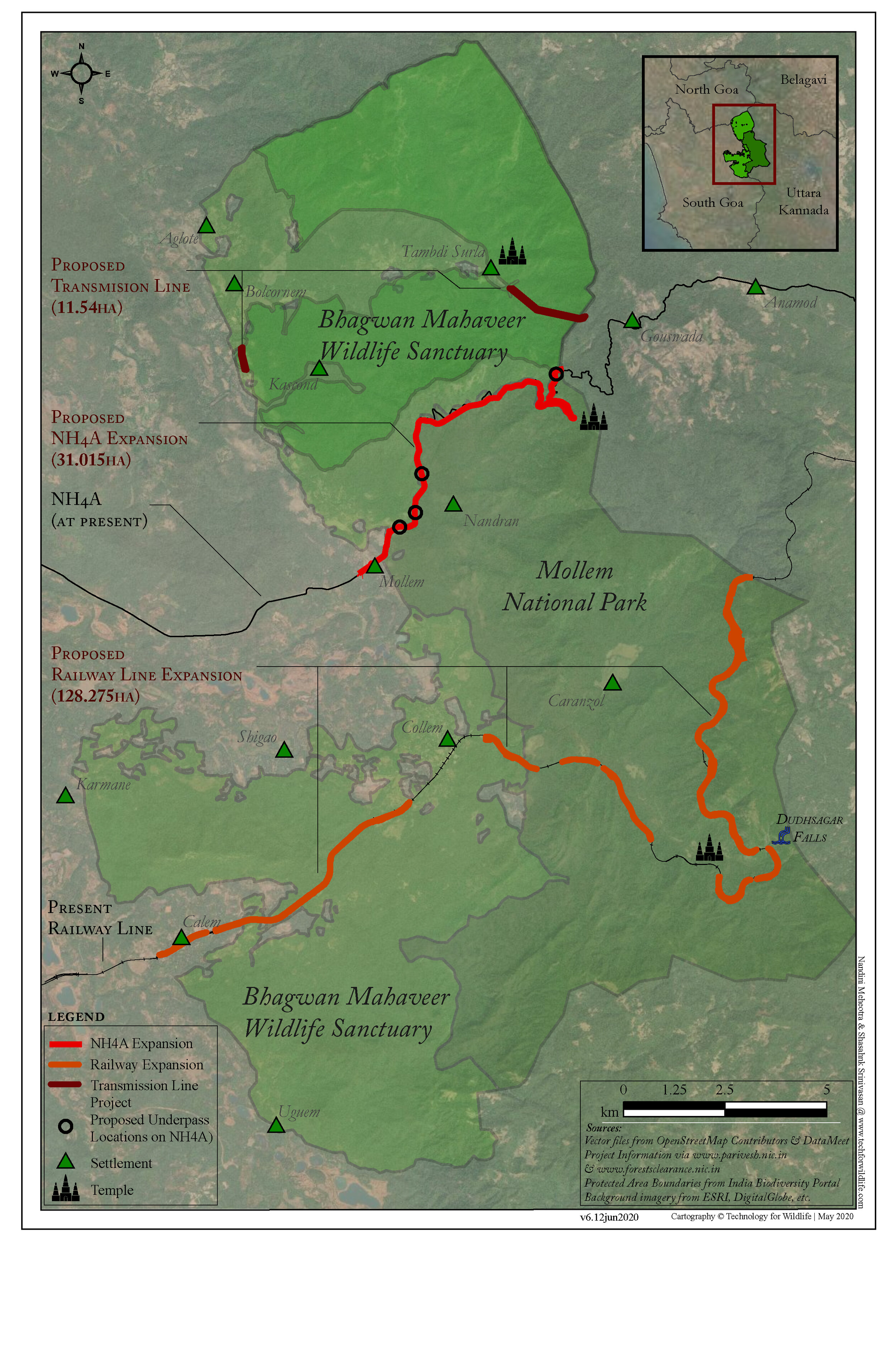
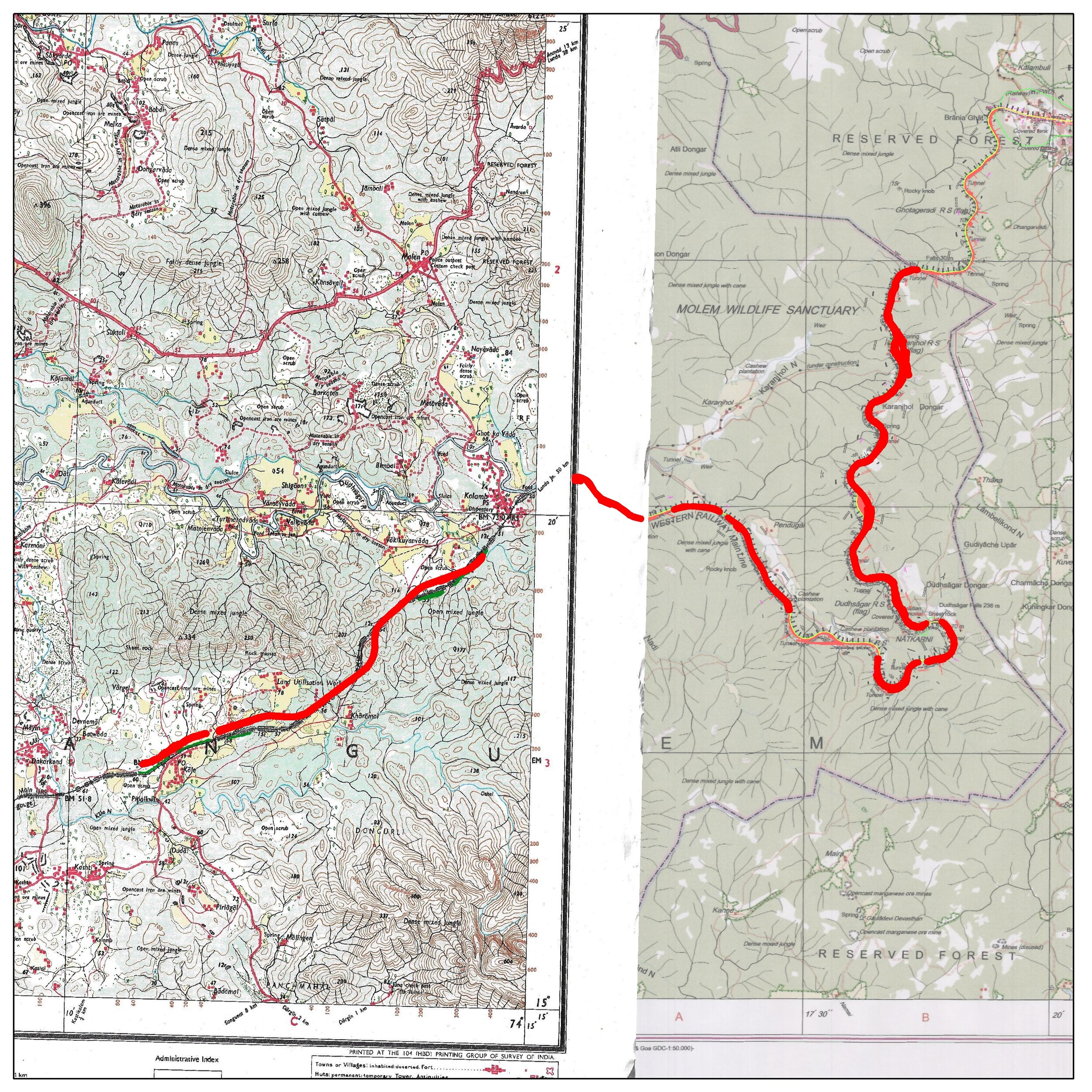
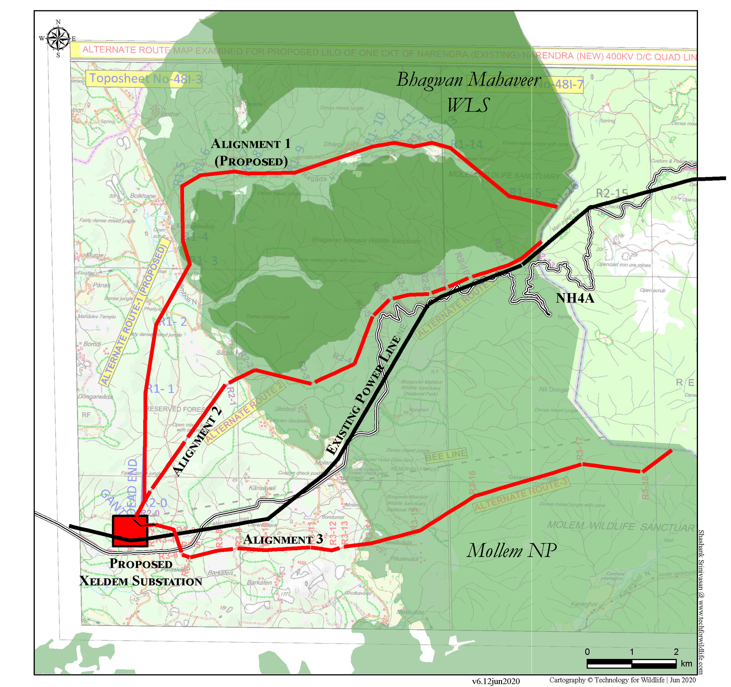
Assisting a citizen’s movement against destructive development
In early 2020, three linear infrastructure projects were approved within the Bhagwan Mahaveer Wildlife Sanctuary and Mollem National Park in Goa, India. Anticipating cumulative impacts that would destroy this section of the biodiversity-rich Western Ghats, a citizen’s movement began to raise awareness about the impact of these projects, and to revisit the official permits provided to these projects. The volunteers leading this movement reached out to us for technical assistance. We collaborated with the #savemollem campaign by using our spatial analysis and conservation science skills to assist with a scientific study on the impacts of these projects, provide evidence for litigation and create information products for the public advocacy campaign.

Mapping coral reefs
Coastal Impact, a marine conservation organisation based in Goa, is working to assist coral reef regeneration around Grande Island, Goa. We’re using our SofarOcean Trident to document and map their field sites, simplifying the evaluation of their project and providing them with media for communication and outreach purposes. Some of the footage collected during our work off the coast of Goa has also been shared with the Allen Coral Atlas, to assist with their work on using AI and satellite imagery to map the world’s coral reefs.
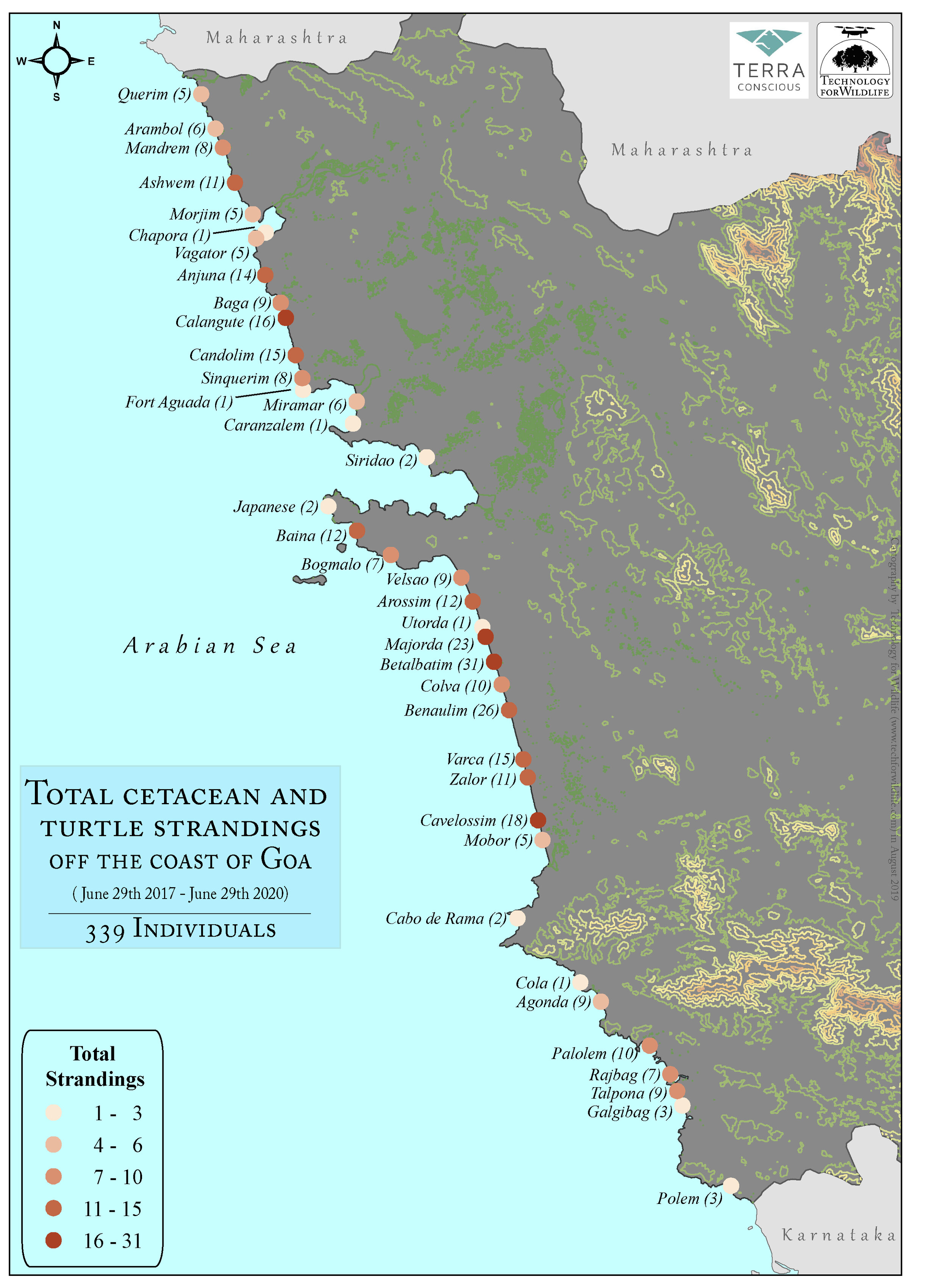
Mapping Marine Wildlife Strandings
Our friends at TerraConscious have set up a network along the coast of Goa that ensures that when marine wildlife are stranded on the beach, the event is recorded and that the animal, if alive, receives timely aid. We’ve been working with them to organise, analyse and map the data they’ve collected since the network’s inception, ensuring that it can be used effectively for conservation advocacy and planning. The next steps with this project are to streamline the data collection process, and create an interactive web-based map that displays this data as it comes in.