Drones, spatial analysis and a 3D model: Asola Bhatti WLS

I recently collected some aerial imagery at the Asola Bhatti Wildlife Sanctuary in Delhi in collaboration with the people who run the outreach centre. I've really been enjoying working with the data, and this project has helped me clarify the various processes I use while using drones. So far, I have a three page checklist and am maintaining a mission log-book as well; keeping all the documentation up to date is hard! In this post, I'll be detailing the various applications I'm using to control the UAV and process the aerial imagery+data it generates, and will then describe a couple of the outputs.

TL;DR: Come for the aerial footage and the 3D models; stay for the process walk-through.

I'm using a DJI Phantom 3 Advanced; the P3A can be manually flown using the controller like a regular R/C plane. To tap into its more advanced functions, fly safely and troubleshoot issues though, it  needs to be connected to a smartphone. I use the DJI Go app on a OnePlus3 (Android) for regular flights, but may switch to an iPad soon; DJI-related apps apparently work better on iOS than on Android.

For mapping missions, there are a number of steps involved. The drone must fly a preset pattern autonomously, collecting images at regular intervals. These images can then be processed into a georeferenced mosaic and used to generate a 3D model. Depending on the use case, these can either be used as-is for visualisation, or analysed further to obtain specific outputs.

For mapping, I use DJI Go to configure the camera settings (exposure and shutter speed), and then use DroneDeploy to take-off and fly the drone along the preset mapping pattern. I'm also experimenting with Pix4D Capture; the UI isn't as clean as DroneDeploy's but the app itself is free, and you don't have to buy into the rest of the Pix4D ecosystem. Once the mapping is complete, I disable DroneDeploy and use DJI Go to manually collect more images from different angles and land the drone at the end of the flight. Once back at base, the images are uploaded into PrecisionMapper, where they're processed in the cloud to create:

  1. a RGB orthomosaic depicting reflectance values (.tif)

  2. a digital surface model representing elevation (.dsm)

  3. a 3D model (.ply and .las)

  4. a KML file for visualisation in Google Earth/Maps (.kml)

  5. a design file for visualisation in CAD software (.dxf)

So far, I've worked with all five of these products; there are more advanced ones available in PrecisionMapper, but I prefer to work directly with these products. I use QGIS and ArcGIS for almost all my satellite imagery analysis work, and these products feed directly into that workflow. The primary output I can create are basic maps; I've never had access to such high-resolution imagery before, so just the simple act of putting a scale bar onto one of these maps is exciting.

The images above are true-colour RGB composites, where the red, green and blue layers have been combined to represent the terrain as a human with unimpaired vision would observe it. The thing with composite bands is that they can also be combined to extract information that it's hard for a human observer to see. In a follow-up (more technical) post, I'll discuss the differences between false-NDVI, SAVI, VARI and TGI, which are all indices that use the RGB layers in interesting ways. In this post though, I'm just going to put in two images that depict the Triangular Greenness Index (TGI), which enhances chlorophyll-containing pixels; the greener the pixel, the more likely it is to contain vegetation.

There are various other algorithms that can be applied to the orthomosaic imagery; PrecisionMapper itself offers a couple that can delineate individual trees or count plants in rows. I'm going to be studying up on what else can be done with this imagery, especially with supervised classification and AI-based analysis processes.

And finally, my favourite output: the 3D model! With enough images from multiple perspectives, modern photogrammetry algorithms can generate vertices and meshes that depict an object or a landscape to scale and in three dimensions. I'm excited about these because while it's really cool to see these embedded in a web-page (as above), it's even cooler to see them carved out in wood or 3D-printed in ABS plastic. It's even possible to pull this into a VR system and explore the terrain in person, or make it the basis of an interactive game or... you get the drift; this is exciting stuff!

Get in touch via our contact form if you have any questions or want to discuss a project of your own.

Drones, aerial imagery, 3D models and VR.

I've been working a lot with drones and aerial imagery recently, and have been really enjoying myself. I'll be writing about a specific project I'm currently undertaking in another blog post, which will include pictures and 3D models. In this post, however, I wanted to jot down a few of the things that are possible with a cheap source of high-quality aerial imagery.

Satellite imagery is amazing; I have made use of it extensively in the past, and continue to do so today. For most applications, the only technical requirements needed to access and use satellite imagery are a good internet connection and a decent computing device.* Satellite imagery has its limitations though; between cheap, timely and high quality, you'll be lucky to get two out of three. This isn't necessarily a problem if you want to understand the movement of glaciers or look at how wetlands have vanished in a region. However, if you want high-quality data depicting a post-disaster site today to help plan humanitarian interventions tomorrow, you may have access to all the satellite imagery in the world but it isn't of much use if there are clouds covering the site.**

There are  applications that satellite imagery isn't suitable for; mapping small areas at a very high resolution, at a chosen time, is a task that drones are far better suited to.*** When I first started using drones, this was what I first thought of drones as: another source of aerial imagery with both advantages and disadvantages. However, prolonged use, lots of reading and lots of tinkering with various photogrammetry software packages has also made me aware of how much more than that they can be.

Drones aren't just flying toys; they're robots. They can be programmed to fly specific patterns while collecting data at specific points. In the case of imagery, which is the application I'm limiting this post to, mobile-based software tools such as DroneDeploy and Pix4Dcapture can make a drone collect imagery automatically over a large area. With a large number of images covering the same area, it's possible to create a very accurate 3D model with 1cm/pixel resolution or better.

For me, this is truly where it gets interesting. With this 3D model, it's possible to undertake formerly-laborious tasks, such as quantifying the biomass in a stand of trees, very easily; 3D models are great for volumetric analysis. It's also possible to use a 3D printer or CNC router to create a physical model, which would make a great art piece or communication tool. Finally, it's possible to use the 3D model as a basemap for a virtual reality experience set within the landscape. In combination with data on the local biodiversity, this could result in amazing products for conservation outreach and research.

*One of the reasons that led me into spatial analysis was that Landsat data became free to use in 2007, right when I was first learning how to use GIS.

** Another issue with satellite imagery used to be overpass times; no matter how large your budget for satellite imagery was, it was still possible that no satellite was in the right position to collect the imagery you wanted. That's rapidly changing; satellite imagery providers such as Planet state that their goal is to have enough satellites in orbit to image the Earth's entire surface once a day.

*** There's a lot of discussion about appropriate nomenclature; do we call them UAVs or drones? My take is that if it's a technical piece where the distinction between robots of various kinds (UAVs, UCAVs, AUVs, ROVs, UGVs) etc is important, then I use the acronyms; if it's just a placeholder for 'flying-robot-without-a-person-inside', I'm going to call it a drone.

A first person account of the capture of a tiger in Northern India: Four elephants, a bulldozer and a drone.

(Cross-posted from WildLabs)

In February 2017, a tiger killed two people within a span of 3 days near the Pilibhit Tiger Reserve in Indian province of Western Uttar Pradesh, and was declared a man-eater. With state elections around the corner, and local villagers threatening to boycott the polls unless the tiger was removed from the area, the Uttar Pradesh Forest Department (UPFD) began an operation with the objective of capturing or killing the tiger. They also called in a drone team to be a part of the operation, primarily to have a highly visible way of broadcasting to the local communities that something was being done to catch the tiger.

Drones are still a novelty in India; the Directorate General for Civil Aviation banned their use by civilians in October 2014 till further regulations were issued, which haven’t arrived till date. However, there are civilian companies who provide drone services, bypassing the regulatory ban through the use of waivers from the authorities, or by working directly for government agencies as was the case in this operation. I was tasked with coordinating between the drone team and the UPFD, and we arrived in Pilibhit on the afternoon of the 10th of February.


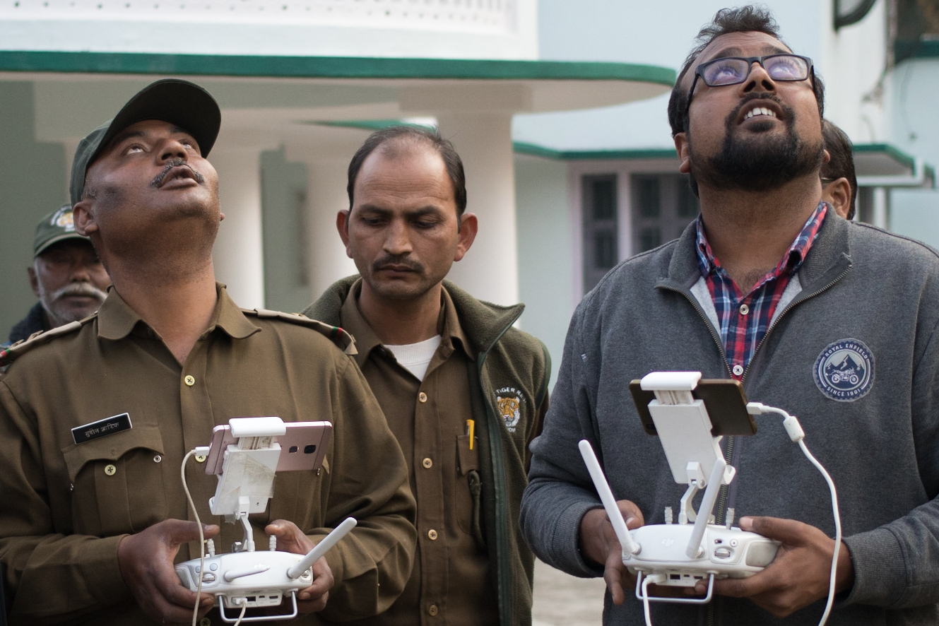
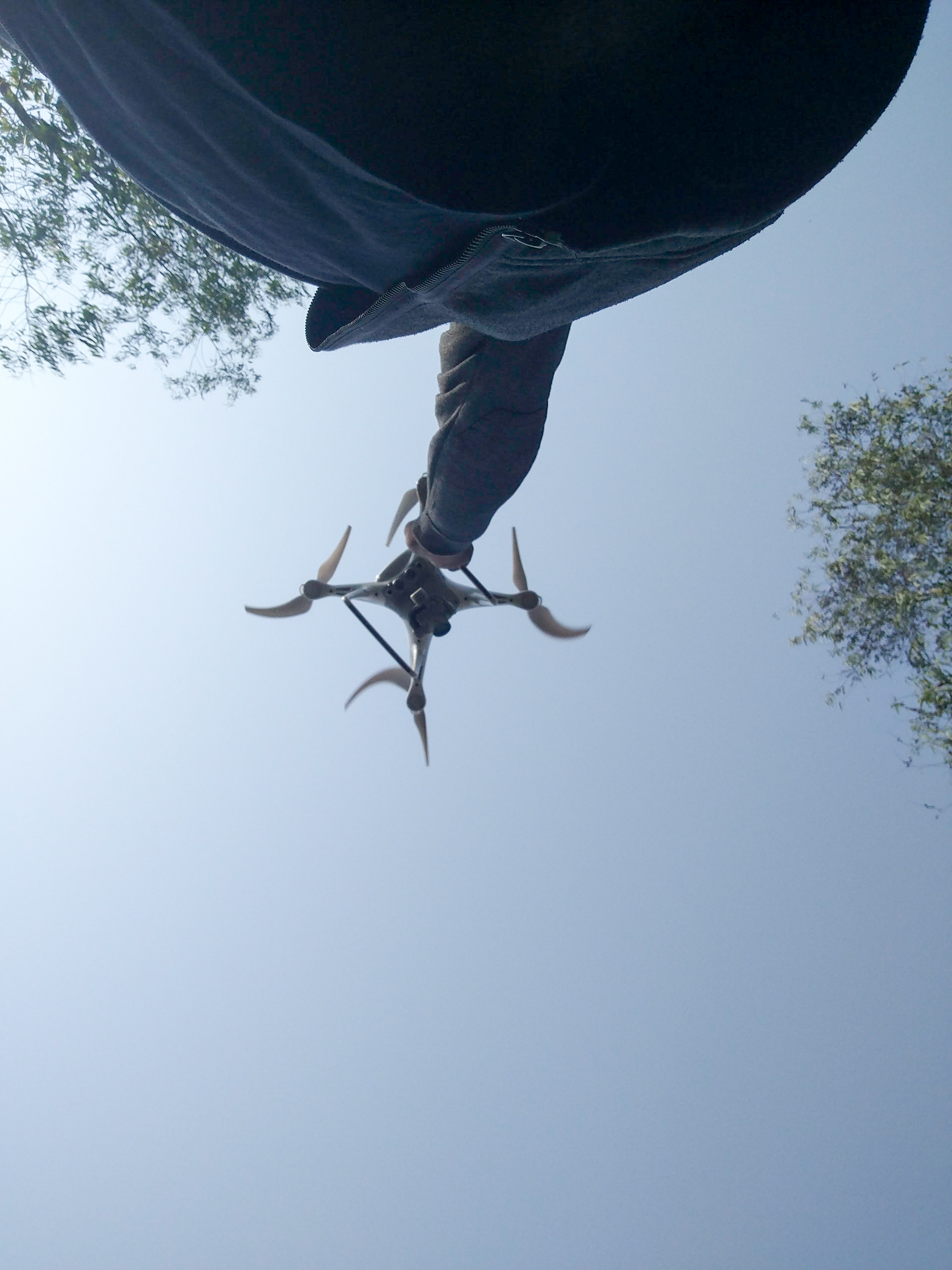
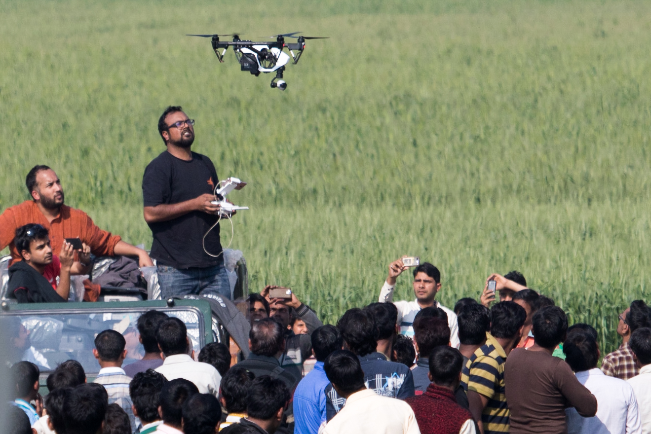
The tiger had been located in a sugarcane patch the previous evening, but had managed to give its hunters the slip. On the day we arrived, extensive search operations were on over a large area to locate the general whereabouts of the tiger. While waiting for information, we demonstrated the use of the drones to the UP Forest Department staff. Both were quadcopters, that is, drones with four rotors that are capable of taking off vertically and of hovering in mid-air like helicopters. One was the consumer-level DJI Phantom 4, while the other was the professional-level DJI Inspire - both are equipped with controllable cameras, and are commonly used for videography purposes. It turned out that the Forest Department also had a Phantom 4 of their own, which they’d brought down from Dudhwa Tiger Reserve. Our drone operators used the afternoon to conduct basic training, showing the UP Forest Department staff how to fly their drone safely and use it for surveillance.

Tiger capture operations can last anywhere from a few days to a few weeks, and often end inconclusively. So our initial plan was to spend at least three days in the area conducting drone operations. Subsequently, depending on how things played out, and how useful the drones were perceived to be, we’d either head back to Delhi or extend our stay in the area.

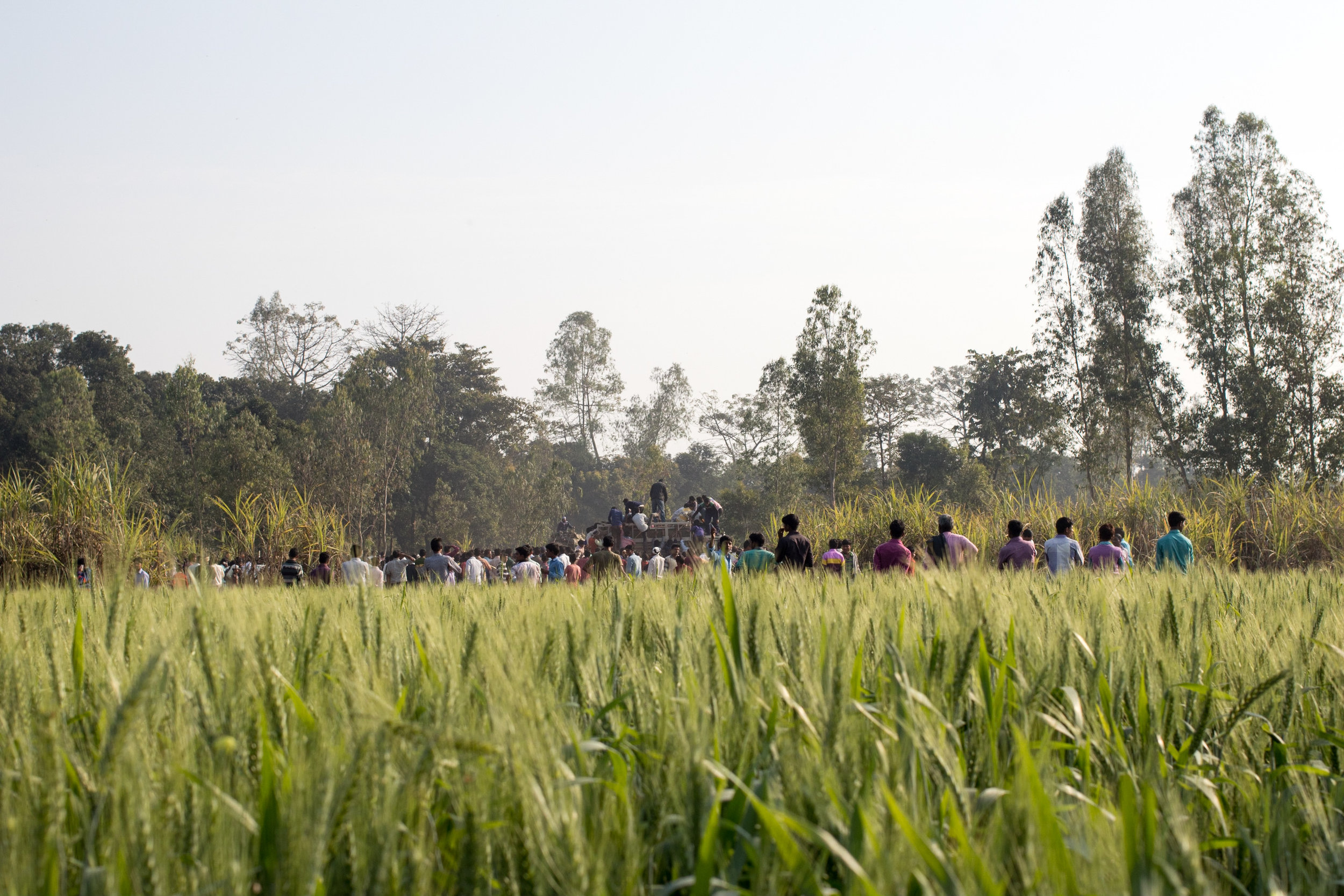
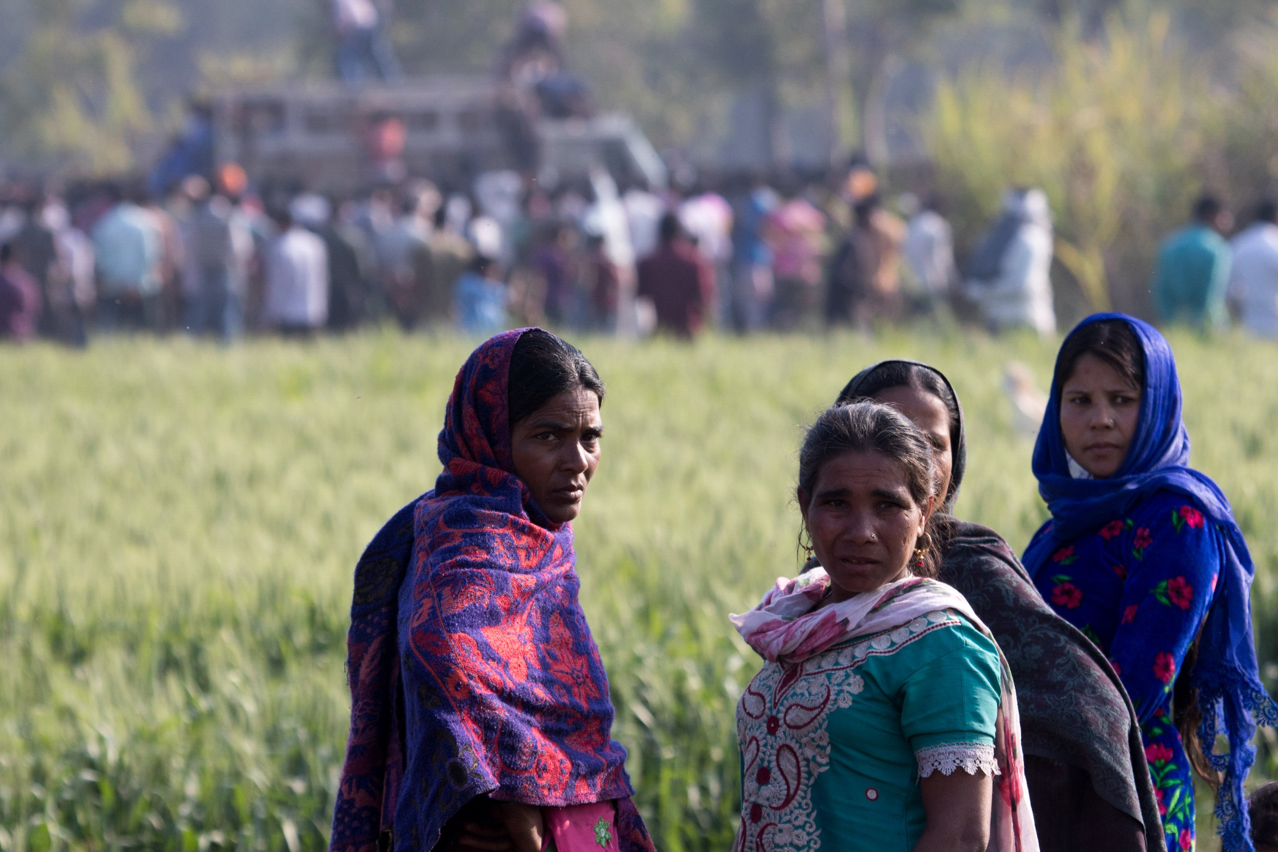
As it turned out, this tiger really was a man-eater; it made its third kill in 5 days in the early morning of the 11th of February. We reached the kill site, in a village to the west of Pilibhit, shortly after we heard the news and saw that a large crowd of people had gathered. One group of people surrounded the Forest Department staff who were interviewing the victim’s brother, while others surrounded local headmen who were giving interviews to the press. There was also a continuous flow of movement as people went to view the body of the last victim, which lay in a sugarcane patch nearby. On the ground, next to a pile of sand not far from the body, was a clearly defined pugmark.

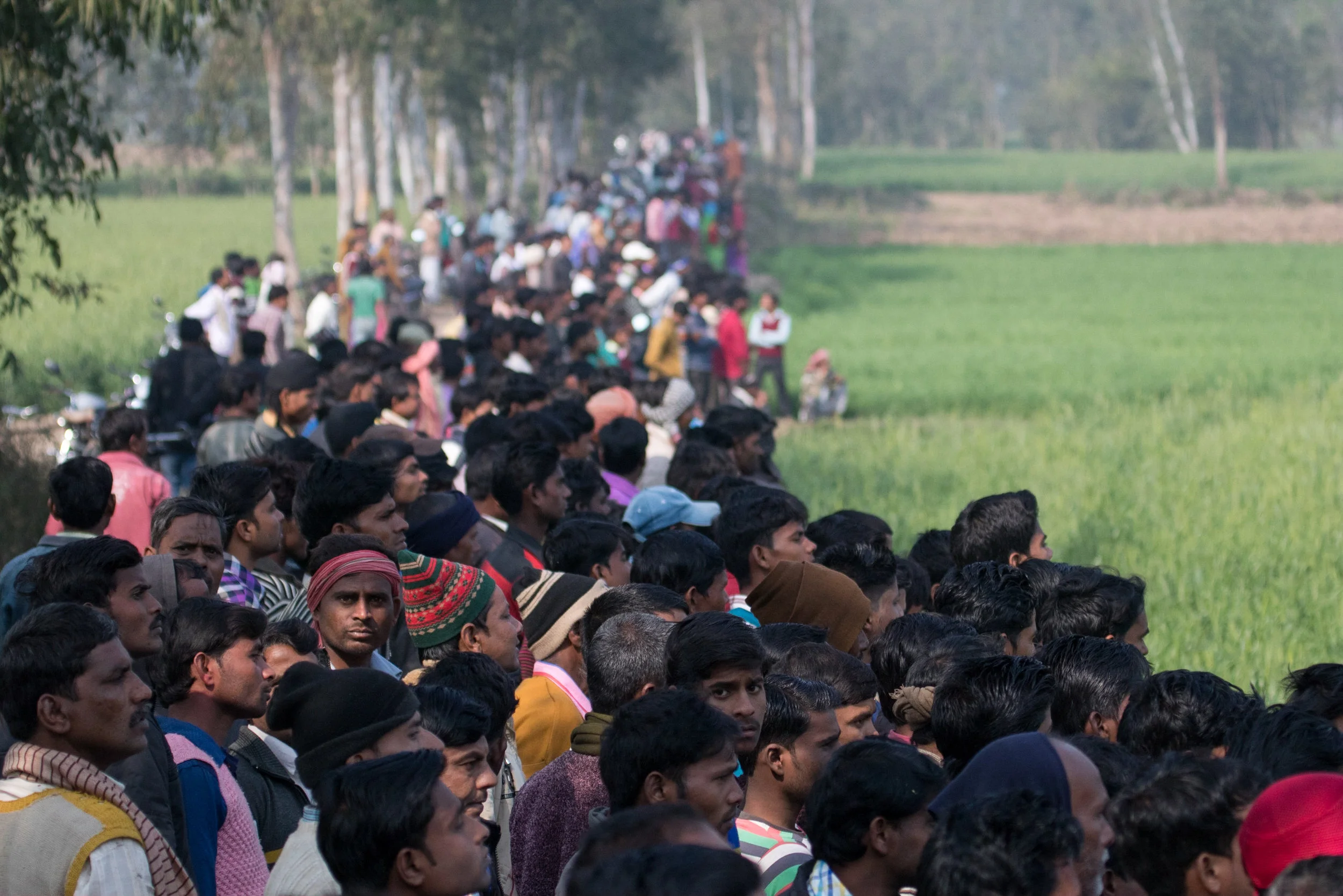
Shortly after we got to the kill site, the Forest Department received information that fresh tiger pugmarks had been found about 2km north of the kill. All the action quickly re-centered itself; two trained Forest Department elephants were summoned and we headed out to that area to join the operation. We sent up the Phantom 4 to scan two large sugarcane patches where the tiger could potentially be hiding, with the camera pointing downwards. We weren’t really expecting to see anything through the dense greenery, and we didn’t. However, while there was a chance that we’d actually find something, these flights also served to keep the crowds that had gathered distracted and away from the elephants, which were searching some distance away.

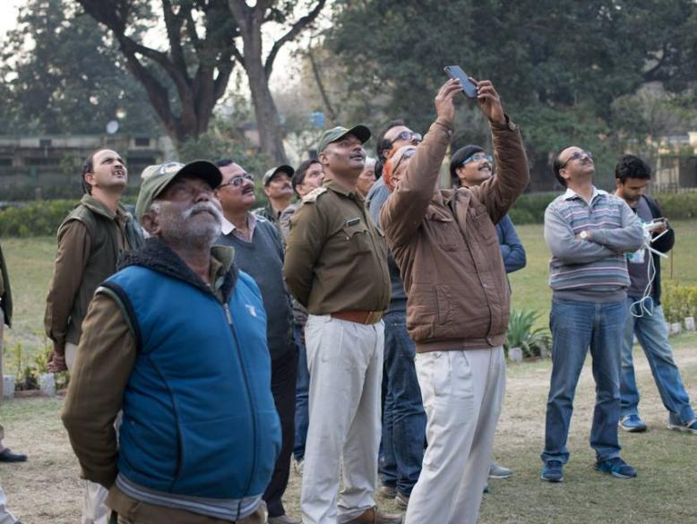
Most people in India haven’t seen drones in action; I live in Delhi and work on drone policy issues, but even I’d only seen them used twice in India before this operation. While one does eventually get used to them, there’s something fascinating about watching these small robots take flight, and the local residents who’d come out in droves to watch the tiger being captured weren’t immune. The open-top safari jeep we were operating the drones out of was constantly surrounded by people, and it’s the closest I’ve ever been to feeling like a movie star. Since there were so many people in close proximity, we were launching the Phantom 4 off the hood of the vehicle but landing it by direct hand-capture, which is a very showy manoeuver. We did this for about 20 minutes, and then word came that the elephants had pinpointed the square plot of sugarcane the tiger was actually hiding in.

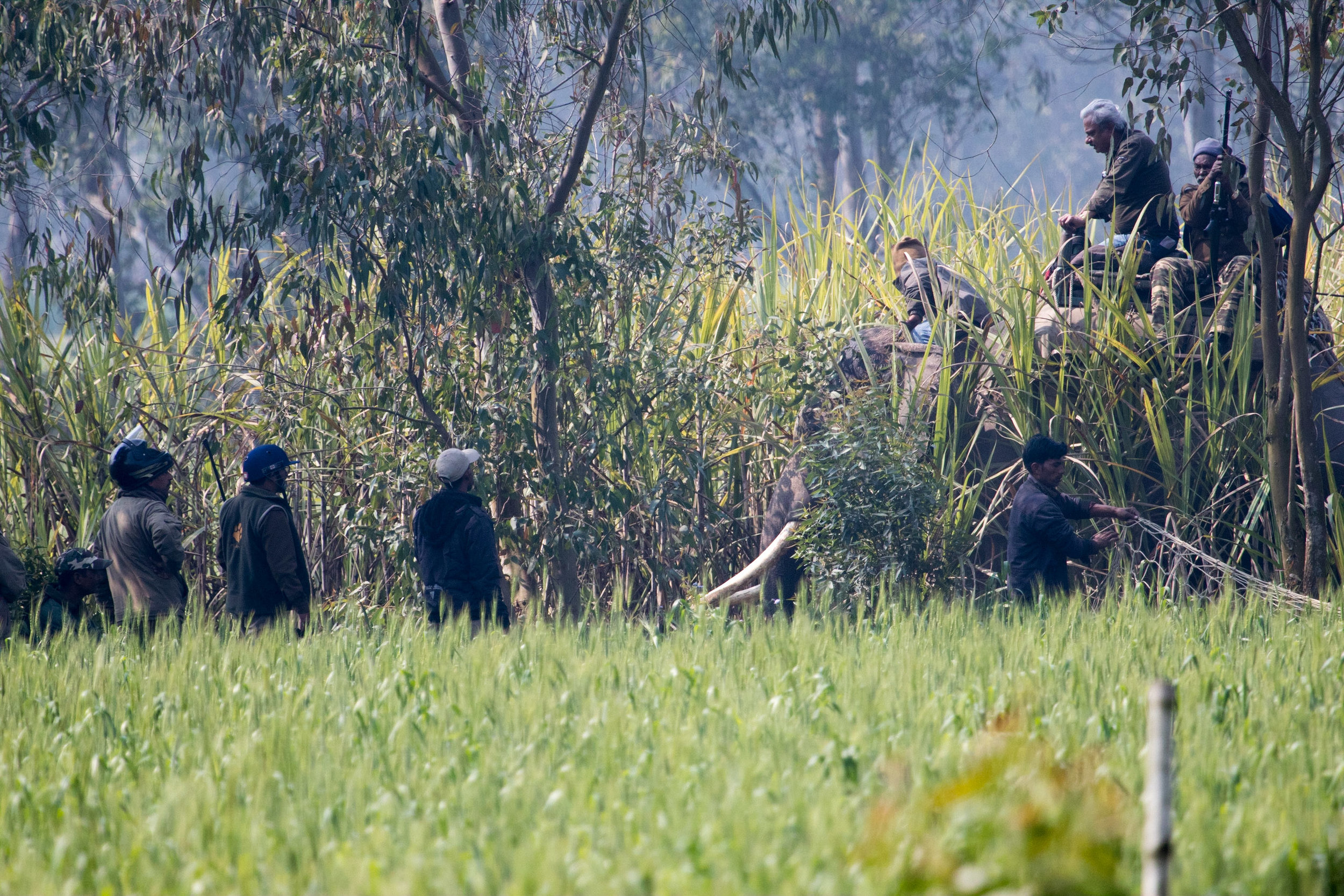
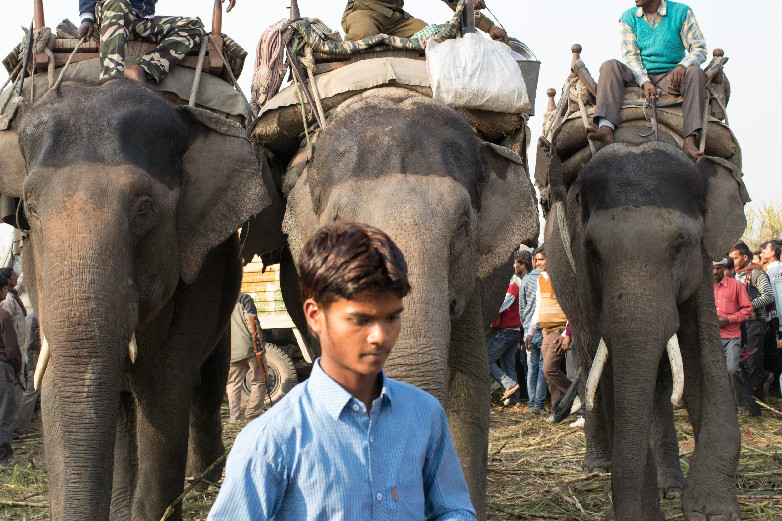
We headed there and kept the drones out of the air till they were called for, watching as the operation unfolded. Forest Department staff set up nets around the outer perimeter, guarded by the veterinarians and forest guards armed with tranquilizer, and regular, guns riding on elephant-back within the sugarcane patch itself. Shortly after the nets were put up, there was the sudden trumpeting of an elephant. We heard that the tiger had charged at one of them, and scratched it near its right eye and on its trunk. The operation then halted for a while as everyone waited for two more trained elephants, a bulldozer and a truck, carrying a cage, to arrive on site.

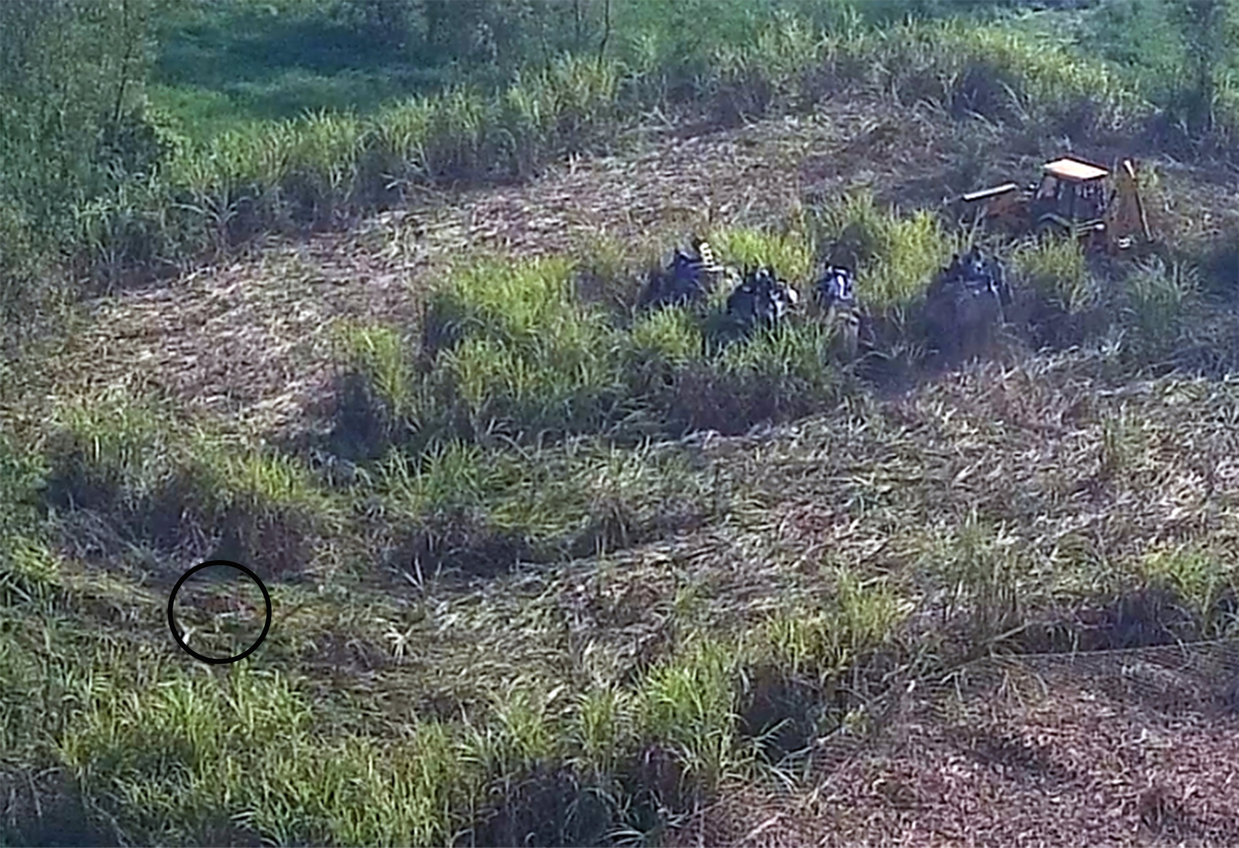
Once all the resources were in place, the bulldozer began spiraling inwards into the sugarcane patch, gradually removing the tiger’s cover while leaving a thin fence of sugarcane along the perimeter. We sent up the larger drone at this point, both to document the operation and to keep it ready in case the Forest Department staff wanted to try and use it to flush the tiger out of the sugarcane.

From our vantage point outside the sugarcane patch, we could see the top of the bulldozer as it slowly mowed down the sugarcane, followed by a view of the elephants, with their riders, moving placidly through the sugarcane patch. It could have been any other calm afternoon, but the peace was suddenly disrupted by a swift burst of confused action. We saw a sudden burst of motion from the elephants, and I heard trumpeting, a roar and two distinct gunshots. However, later review of the video footage from the drone made the sequence of events much clearer. The bulldozer had removed most of the sugarcane, leaving only a small central patch standing, and once it was done, the four elephants took a circuit of the central patch. At the point the action had begun, two of the elephants either sensed the tiger, or their riders spotted it. Either way, both elephants wheeled to the left and charged into the sugarcane patch, and the other two followed. All four flailed around in the sugarcane. A little distance away, there was movement in the underbrush, and then the tiger burst out into the circle cleared by the bulldozer, and then dashed back into cover in the sugarcane left standing along the perimeter.

As it turned out, the veterinarians had managed to shoot the tiger with at least one tranquilizer dart. The elephants and their riders were pulled back as everyone waited to make sure that the tranquilizers had taken effect. In the meanwhile, the tiger doubled back into the sugarcane patch and then passed out. Two of the elephants then went back in to the patch, and once the personnel on elephant-back confirmed that the tiger had been incapacitated, they called the truck with the cage in. They dismounted from the elephants, quickly carried the tiger to the truck, pushed it into the cage and locked it. 

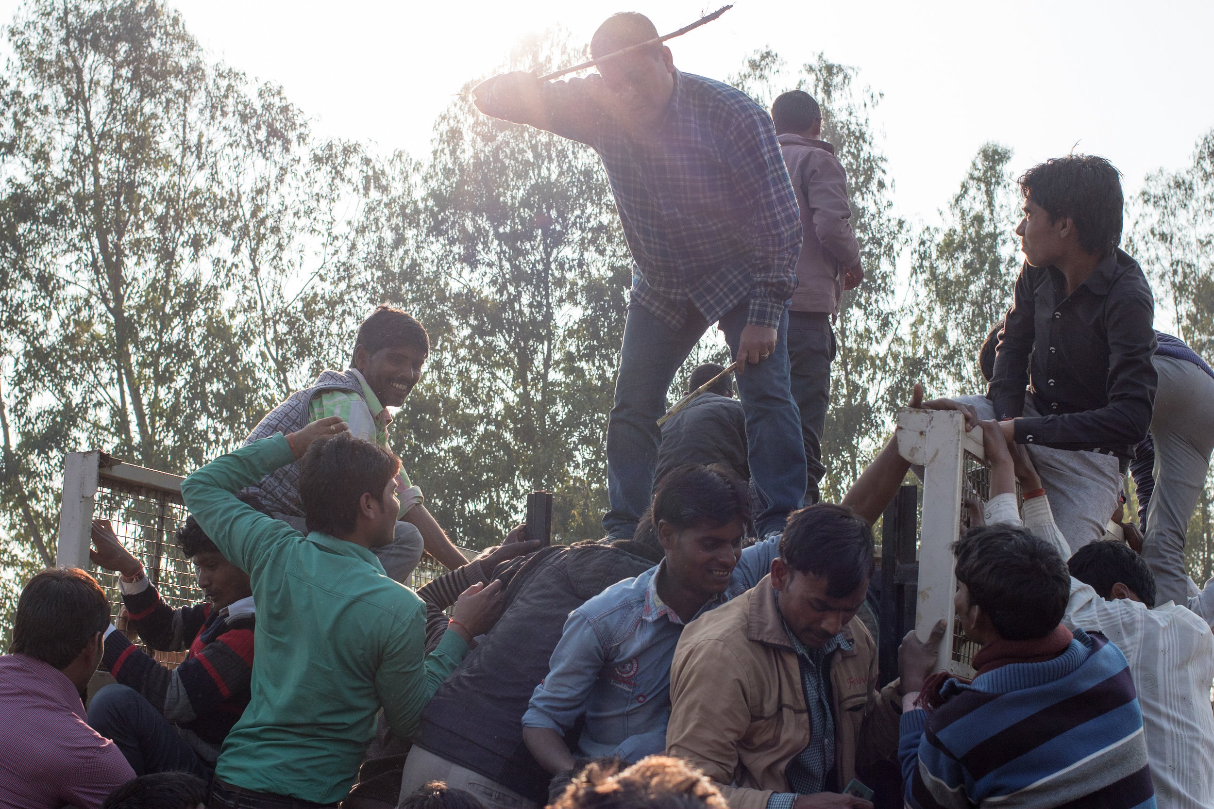
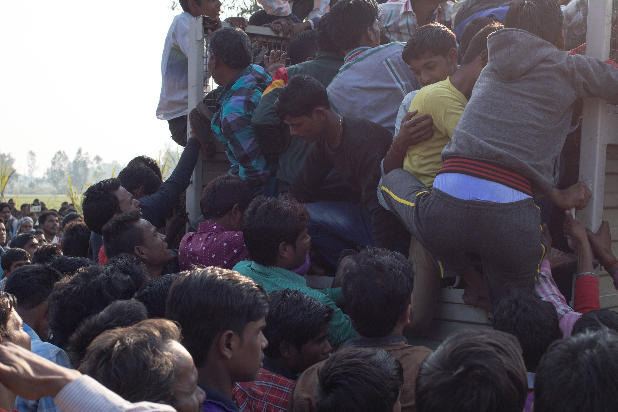
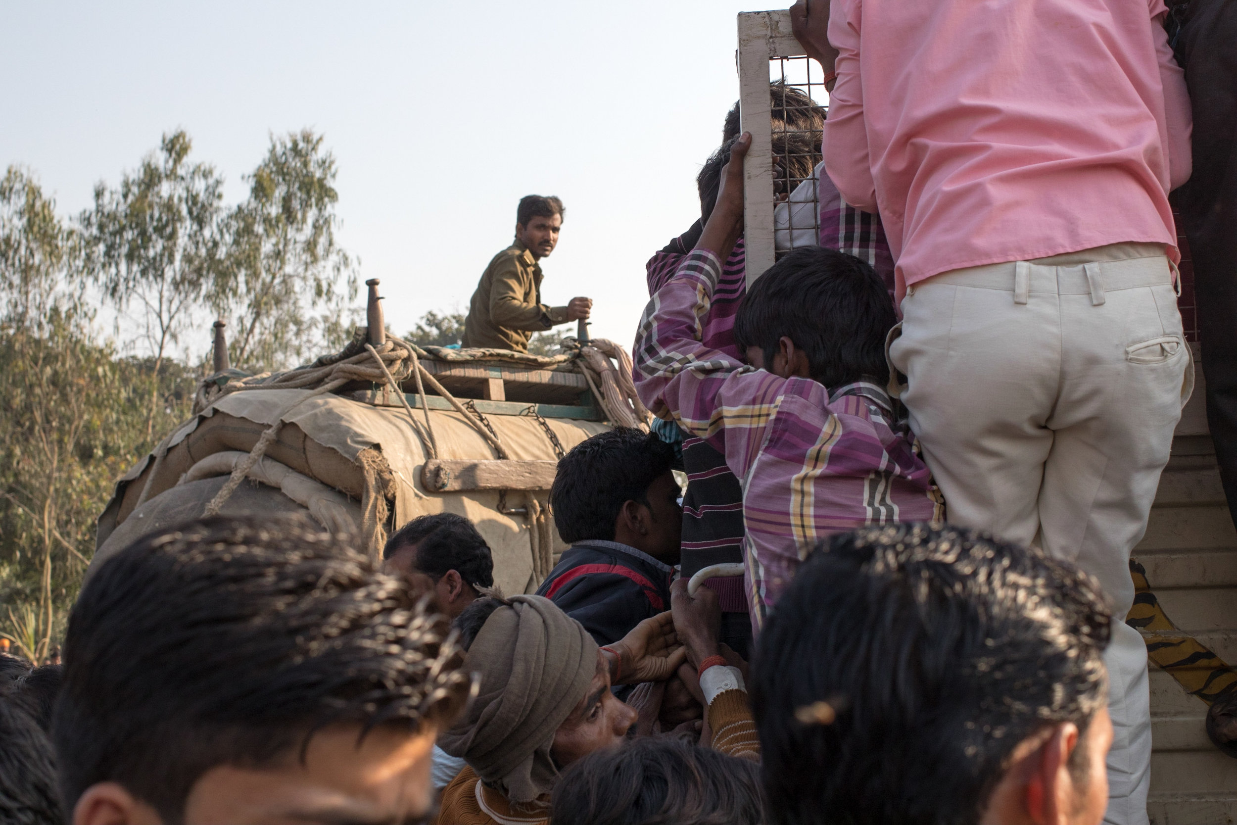
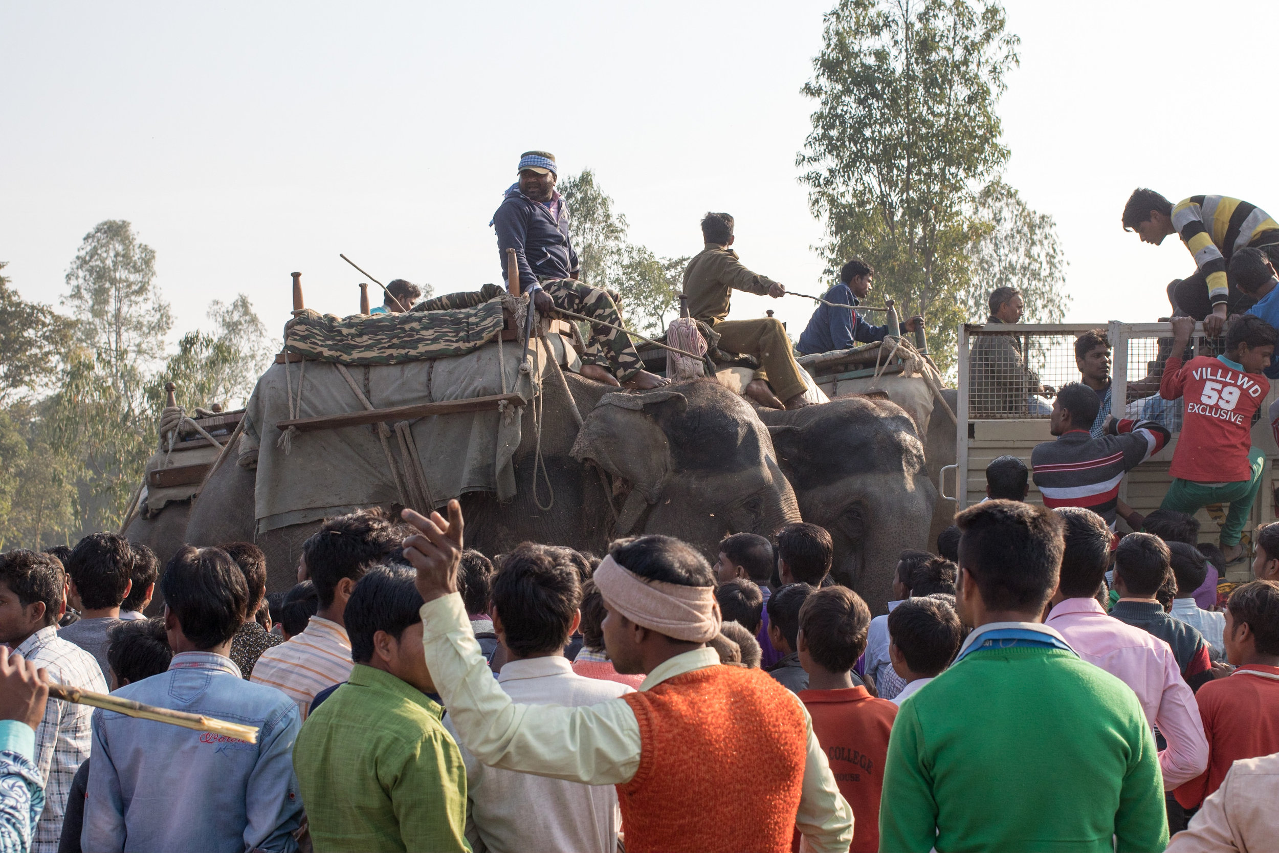
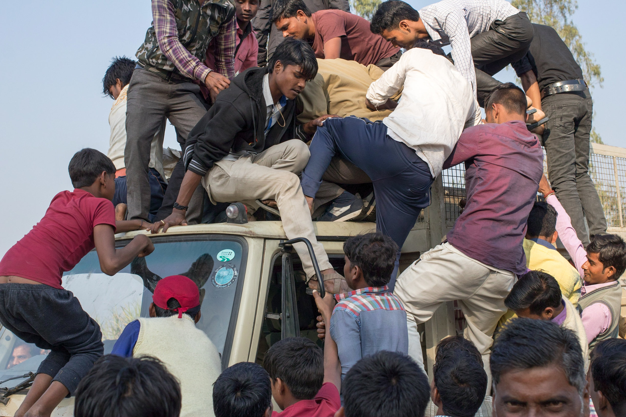
It’s at this point that the surrounding crowds stormed the site and climbed onto the truck, snatched the keys from its hapless driver and slashed its tires. Newspaper reports of the day claim that the ‘angry locals’ also tried to set it on fire, but I didn’t see any evidence of that. Also, while I’m sure that there was anger and resentment on the part of the local communities against the man-eating tiger, the Forest Department and the State Government, I don’t think that the crowd itself was angry. I’ve grown up in Kolkata when it was under Communist rule, and I’ve seen angry mobs on the streets. This, however, seemed to be a crowd composed primarily of young men who were torn between wanting to hurt the tiger, see the tiger or merely be a part of the giant party in progress. The abundance of freshly-bulldozed sugarcane proved to be attractive to the mob - while some of it was being gnawed upon by those on the fringes of the mob, a lot of it was thrown at the truck, at other people or into the air. The elephants with their mahouts were still on the field near the truck, being used to help control the crowd. When one of the airborne sugarcane sticks went very close to one of the elephants, its mahout glared at the section of people from where it had come, and that was the end of the sugarcane throwing.

The Forest Department staff behaved admirably; once it was clear that the crowd couldn’t actually get to the tiger within the cage and harm it, they pulled the elephants out to one side, and kept them facing away from the crowd. They’d sent for a tractor to pull the disabled truck with the cage away, and in the meantime let the crowd spend its passion and energy climbing all over the truck and the cage. It was only when the tractor arrived that the Forest Department staff, and some police who’d been deputised to help, set up a cordon around the truck and made a real effort to push the people off. The truck was then attached to the tractor by ropes, and towed away with its captive and unconscious inhabitant.

The removal of the tiger from the site marked the end of the operation.  It was successfully captured alive and sent to the Lucknow zoo. The elephants, their mahouts and the drone operators were thanked for their service, and everyone went on their way. While the drone deployment provided a useful record, and a unique perspective on the events of the day, it was the tried and tested age-old technique of hunting tigers, using beaters (or in this case, a bulldozer) and riders on elephant-back, that resulted in a successful resolution to the story of one of the man-eaters of Pilibhit in 2017.

With thanks to Ayush, Shakti, Harshad, Mudit, Naresh and Jaspreet.